
Magnitude |
:2.3 |
| Date & Time (UTC) | 2004-10-01 07:32:09.6 |
| Date & Time (Local) | 1383/7/10 11:02:09.6 |
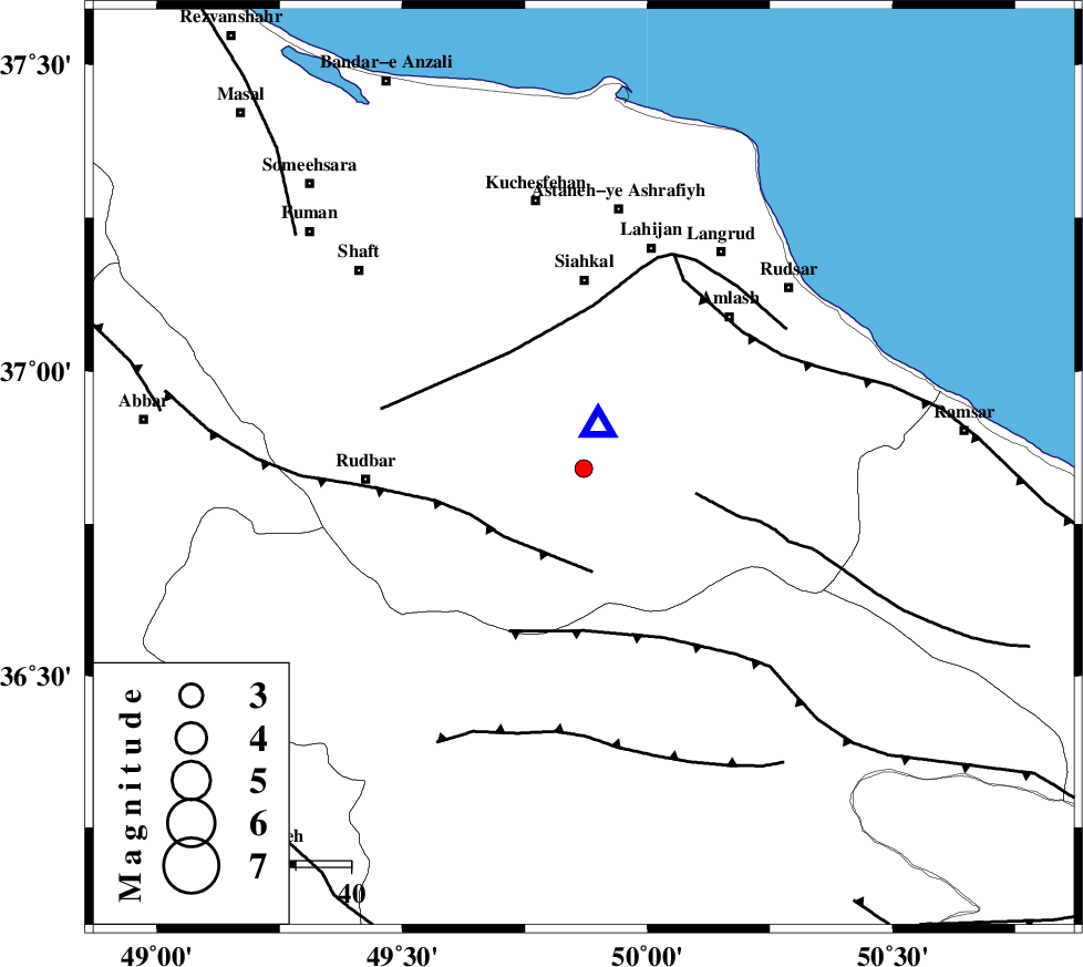
| Location | Lat:36.84 Lon: 49.87 |
| Region | 33 km South of Siahkal, Gilan Province |
Nearest Cities |
|
| 3 km of Barresar, Gilan Province | |
| 16 km North West of Kelishom, Gilan Province | |
| 17 km North of Jirhandeh, Gilan Province | |
| 18 km East of Dashtvil, Gilan Province | |
| 22 km South of Khorma, Gilan Province | |
| Depth | 14 km |
| Agency | |
Faults within 150 km: |
|
| RUDBAR_F (Length: 93 km) , Distance to epicenter: 19 km | |
| BONAN_F (Length: 74 km) , Distance to epicenter: 21 km | |
| LAHIJAN_F (Length: 92 km) , Distance to epicenter: 25 km | |
| Number of Phases | 5 |
| RMS | 0.1 |
| Number of Stations | 3 |
| Error in Latitude | >6.9 km |
| Error in Longitude | 16.3 km |
| Error in Depth | 12.8 km |
Download waveform in seisan format
to download seisan software Click here
to access information about IIEES stations Click here
Amplitude | ||||||||
| UID | Agency | Station | Component | Amplitude | Period | Arrival Time | Proccessing Time | Signal Clip |
| 30379 | IIEES | THKV | N | 92.7 | 0.1 | 2004-10-01 07:32:50 | 2006-03-15 11:56:00 | n |
| 30380 | IIEES | THKV | E | 97.2 | 0.21 | 2004-10-01 07:32:51 | 2006-03-15 11:56:00 | n |
| 30381 | IIEES | ASAO | N | 12 | 0.27 | 2004-10-01 07:33:20 | 2006-03-15 11:56:00 | n |
| 30382 | IIEES | ASAO | E | 11 | 0.49 | 2004-10-01 07:33:20 | 2006-03-15 11:56:00 | n |
Phase | ||||||||||||
| Agency | Station | Component | Phase Type | Phase Quality | First Motion | Observed Arrival Time | Time Residual | Loc. Flag | Input Weight | Distance | Azimuth | |
| IIEES | THKV | Z | PG | E | 2004-10-01 07:32:32 | 0 | y | 137 | 138 | |||
| IIEES | THKV | N | SG | E | 2004-10-01 07:32:49 | 0 | y | 137 | 138 | |||
| IIEES | ASAO | Z | PN | E | 2004-10-01 07:32:49 | -0.2 | y | 255 | 177 | |||
| IIEES | ASAO | E | SN | 2004-10-01 07:33:18 | 0.1 | y | 255 | 177 | ||||
| IIEES | GRMI | Z | PN | E | 2004-10-01 07:32:52 | 0.1 | y | 279 | 322 | |||