
Magnitude |
:2.6 |
| Date & Time (UTC) | 2004-08-04 21:34:59.8 |
| Date & Time (Local) | 1383/5/15 02:04:59.8 |
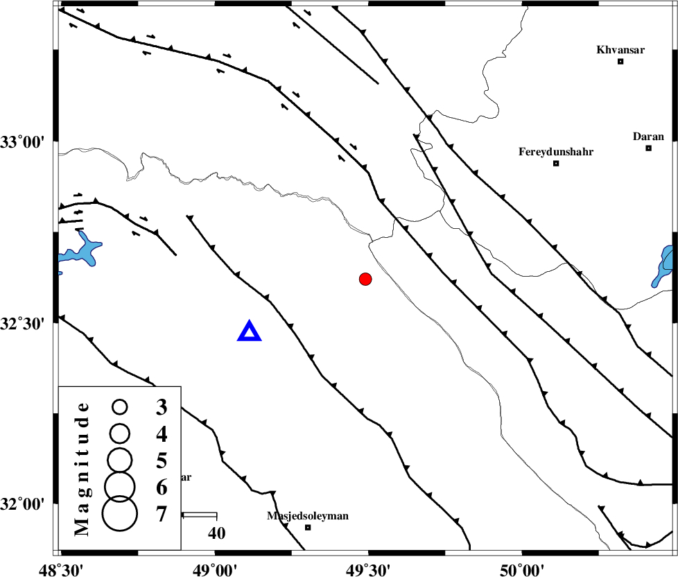
| Location | Lat:32.62 Lon: 49.49 |
| Region | 43 km North-East of Lali, Khoozestan Province |
Nearest Cities |
|
| 32 km South of Parchal, Lorestan Province | |
| 36 km West of Durak, Chaharmahal Bakhtiari Province | |
| 37 km North of Paabshalal, Khoozestan Province | |
| 42 km South West of Masir, Esfahan Province | |
| 44 km North East of Lali, Khoozestan Province | |
| Depth | 14 km |
| Agency | |
Faults within 150 km: |
|
| ZARDKUH_F (Length: 139 km) , Distance to epicenter: 24 km | |
| HZF4 (Length: 492 km) , Distance to epicenter: 25 km | |
| MFF2 (Length: 205 km) , Distance to epicenter: 27 km | |
| Number of Phases | 4 |
| RMS | 0 |
| Number of Stations | 3 |
| Error in Latitude | >3.4 km |
| Error in Longitude | 7.5 km |
| Error in Depth | 6 km |
Download waveform in seisan format
to download seisan software Click here
to access information about IIEES stations Click here
Amplitude | ||||||||
| UID | Agency | Station | Component | Amplitude | Period | Arrival Time | Proccessing Time | Signal Clip |
| 28042 | IIEES | ASAO | N | 64.2 | 0.54 | 2004-08-04 21:36:08 | 2006-03-15 11:56:00 | n |
| 28043 | IIEES | NASN | N | 19.4 | 0.47 | 2004-08-04 21:36:24 | 2006-03-15 11:56:00 | n |
Phase | ||||||||||||
| Agency | Station | Component | Phase Type | Phase Quality | First Motion | Observed Arrival Time | Time Residual | Loc. Flag | Input Weight | Distance | Azimuth | |
| IIEES | ASAO | Z | PG | E | 2004-08-04 21:35:36 | 0 | y | 220 | 13 | |||
| IIEES | ASAO | E | SG | E | 2004-08-04 21:36:02 | 0 | y | 220 | 13 | |||
| IIEES | NASN | Z | PN | E | 2004-08-04 21:35:46 | 0 | y | 312 | 85 | |||
| IIEES | THKV | Z | PN | E | 2004-08-04 21:35:55 | 0 | y | 388 | 19 | |||