
Magnitude |
:2.4 |
| Date & Time (UTC) | 2005-05-17 20:39:02.2 |
| Date & Time (Local) | 1384/2/28 01:09:02.2 |
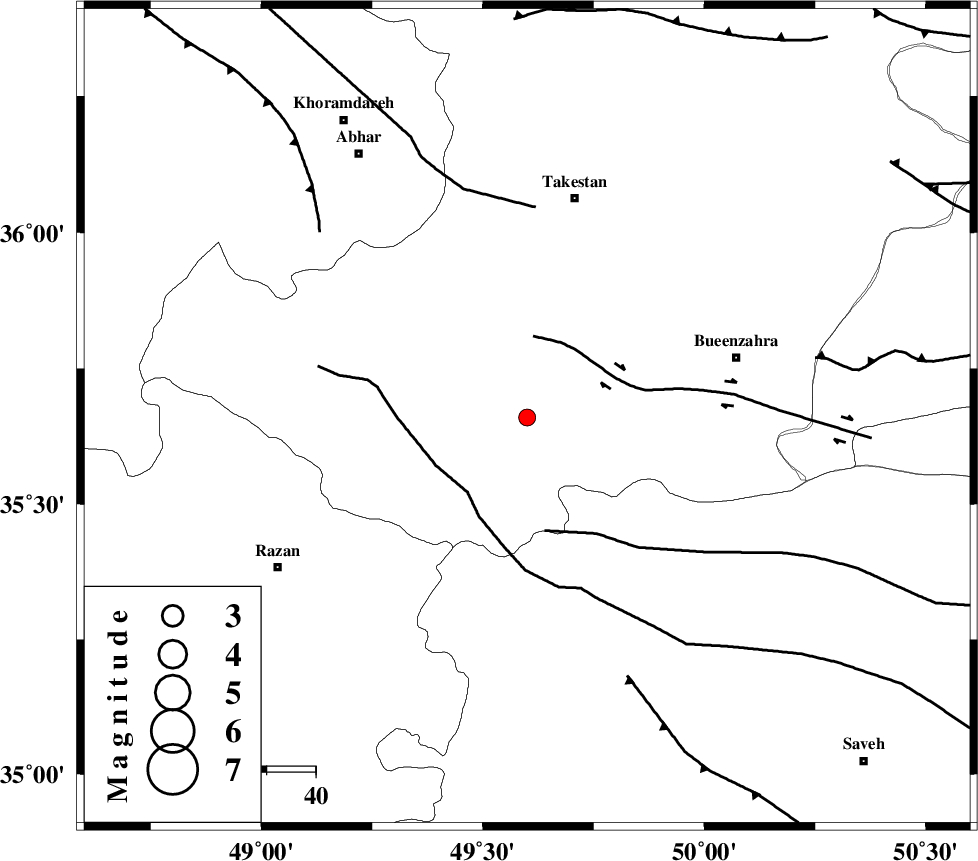
| Location | Lat:35.66 Lon: 49.6 |
| Region | |
Nearest Cities |
|
| 13 km North East of Kolanjin, Ghazvin Province | |
| 19 km South West of Danesfahan, Ghazvin Province | |
| 27 km South East of Hoseynabad, Ghazvin Province | |
| 30 km East of Ab-e garm, Ghazvin Province | |
| 31 km South West of Shal, Ghazvin Province | |
| Depth | 46 km |
| Agency | |
Faults within 150 km: |
|
| IPAK_F (Length: 80 km) , Distance to epicenter: 17 km | |
| KUSHK_E_NOSRAT_F (Length: 230 km) , Distance to epicenter: 20 km | |
| S_PARANDAK_F (Length: 116 km) , Distance to epicenter: 24 km | |
| Number of Phases | 7 |
| RMS | 0.1 |
| Number of Stations | 4 |
| Error in Latitude | >1.7 km |
| Error in Longitude | 1.2 km |
| Error in Depth | 9 km |
Download waveform in seisan format
to download seisan software Click here
to access information about IIEES stations Click here
Amplitude | ||||||||
| UID | Agency | Station | Component | Amplitude | Period | Arrival Time | Proccessing Time | Signal Clip |
| 5782 | IIEES | SNGE | N | 16.6 | 0.52 | 2005-05-17 20:40:04 | 2005-07-05 05:11:00 | n |
| 5783 | IIEES | DAMV | E | 56.8 | 0.12 | 2005-05-17 20:40:05 | 2005-07-05 05:11:00 | n |
Phase | ||||||||||||
| Agency | Station | Component | Phase Type | Phase Quality | First Motion | Observed Arrival Time | Time Residual | Loc. Flag | Input Weight | Distance | Azimuth | |
| IIEES | ASAO | Z | PG | E | 2005-05-17 20:39:24 | 0 | y | 129.7 | 162 | |||
| IIEES | ASAO | E | SG | E | 2005-05-17 20:39:40 | 0 | y | 129.7 | 162 | |||
| IIEES | THR | Z | PG | E | 2005-05-17 20:39:25 | -0.1 | y | 140.7 | 78 | |||
| IIEES | THR | E | SG | E | 2005-05-17 20:39:43 | 0.1 | y | 140.7 | 78 | |||
| IIEES | SNGE | Z | PG | E | 2005-05-17 20:39:37 | 0 | y | 214.2 | 253 | |||
| IIEES | SNGE | E | SG | E | 2005-05-17 20:40:02 | 0 | y | 214.2 | 253 | |||
| IIEES | DAMV | Z | PG | E | 2005-05-17 20:39:37 | 0 | y | 214.9 | 90 | |||