
Magnitude |
:3.1 |
| Date & Time (UTC) | 2005-04-29 07:55:53.3 |
| Date & Time (Local) | 1384/2/9 12:25:53.3 |
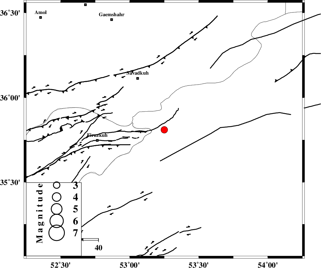
| Location | Lat:35.81 Lon: 53.25 |
| Region | |
Nearest Cities |
|
| 9 km North of Shahmirzad, Semnan Province | |
| 9 km of Chashem, Semnan Province | |
| 14 km North of Mehdishahr, Semnan Province | |
| 27 km North East of Aftar, Semnan Province | |
| 29 km South of Sangdeh, Mazandaran Province | |
| Depth | 17 km |
| Agency | |
Faults within 150 km: |
|
| ATARI_F (Length: 185 km) , Distance to epicenter: 17 km | |
| N_ALBORZ_F (Length: 360 km) , Distance to epicenter: 45 km | |
| MOSHA_F (Length: 234 km) , Distance to epicenter: 56 km | |
| Number of Phases | 6 |
| RMS | 0 |
| Number of Stations | 5 |
| Error in Latitude | >4.6 km |
| Error in Longitude | 3.5 km |
| Error in Depth | 5.6 km |
Download waveform in seisan format
to download seisan software Click here
to access information about IIEES stations Click here
Amplitude | ||||||||
| UID | Agency | Station | Component | Amplitude | Period | Arrival Time | Proccessing Time | Signal Clip |
| 5596 | IIEES | DAMV | N | 432.1 | 0.27 | 2005-04-29 07:56:35 | 2005-07-05 05:11:00 | n |
| 5597 | IIEES | ASAO | N | 80.5 | 0.32 | 2005-04-29 07:57:27 | 2005-07-05 05:11:00 | n |
| 5598 | IIEES | NASN | N | 50.2 | 0.37 | 2005-04-29 07:57:40 | 2005-07-05 05:11:00 | n |
Phase | ||||||||||||
| Agency | Station | Component | Phase Type | Phase Quality | First Motion | Observed Arrival Time | Time Residual | Loc. Flag | Input Weight | Distance | Azimuth | |
| IIEES | DAMV | Z | PG | E | 2005-04-29 07:56:13 | 0 | y | 117.2 | 261 | |||
| IIEES | DAMV | N | SG | E | 2005-04-29 07:56:27 | 0 | y | 117.2 | 261 | |||
| IIEES | THR | Z | PG | E | 2005-04-29 07:56:24 | -0.1 | y | 192 | 274 | |||
| IIEES | THKV | Z | PG | E | 2005-04-29 07:56:28 | 0.1 | y | 214.3 | 274 | |||
| IIEES | ASAO | Z | PN | E | 2005-04-29 07:56:41 | 0 | y | 325 | 246 | |||
| IIEES | NASN | Z | PN | E | 2005-04-29 07:56:42 | 0 | y | 335.9 | 187 | |||