
Magnitude |
:2.5 |
| Date & Time (UTC) | 2005-04-27 03:27:52.9 |
| Date & Time (Local) | 1384/2/7 07:57:52.9 |
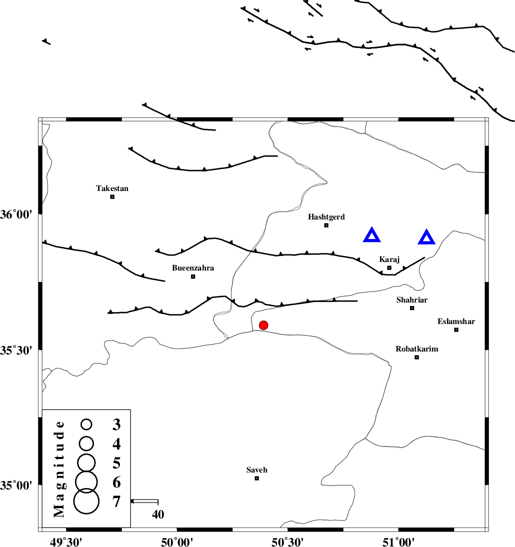
| Location | Lat:35.59 Lon: 50.39 |
| Region | |
Nearest Cities |
|
| 15 km South of Eshtehard, Tehran Province | |
| 22 km North of Khoshkrud, Markazi Province | |
| 27 km North West of Zaviyeh, Markazi Province | |
| 29 km South West of Palangabad, Tehran Province | |
| 30 km North West of Hakimabad, Markazi Province | |
| Depth | 18 km |
| Agency | |
Faults within 150 km: |
|
| IPAK_F (Length: 80 km) , Distance to epicenter: 4 km | |
| ESHTEHARD_F (Length: 69 km) , Distance to epicenter: 18 km | |
| S_PARANDAK_F (Length: 116 km) , Distance to epicenter: 23 km | |
| Number of Phases | 7 |
| RMS | 0.1 |
| Number of Stations | 4 |
| Error in Latitude | >1.8 km |
| Error in Longitude | 2.4 km |
| Error in Depth | 0 km |
Download waveform in seisan format
to download seisan software Click here
to access information about IIEES stations Click here
Amplitude | ||||||||
| UID | Agency | Station | Component | Amplitude | Period | Arrival Time | Proccessing Time | Signal Clip |
| 5581 | IIEES | ASAO | N | 83.9 | 0.2 | 2005-04-27 03:28:28 | 2005-07-05 05:11:00 | n |
| 5582 | IIEES | DAMV | N | 91.2 | 0.24 | 2005-04-27 03:28:37 | 2005-07-05 05:11:00 | n |
Phase | ||||||||||||
| Agency | Station | Component | Phase Type | Phase Quality | First Motion | Observed Arrival Time | Time Residual | Loc. Flag | Input Weight | Distance | Azimuth | |
| IIEES | THKV | Z | PG | E | 2005-04-27 03:28:03 | 0.1 | y | 56.94 | 51 | |||
| IIEES | THR | Z | PG | E | 2005-04-27 03:28:06 | -0.1 | y | 75.24 | 62 | |||
| IIEES | THR | N | SG | E | 2005-04-27 03:28:15 | 0.1 | y | 75.24 | 62 | |||
| IIEES | ASAO | Z | PG | E | 2005-04-27 03:28:13 | 0 | y | 120.6 | 196 | |||
| IIEES | ASAO | E | SG | E | 2005-04-27 03:28:28 | 0 | y | 120.6 | 196 | |||
| IIEES | DAMV | Z | PG | E | 2005-04-27 03:28:16 | -0.2 | y | 143.4 | 88 | |||
| IIEES | DAMV | N | SG | E | 2005-04-27 03:28:34 | 0.1 | y | 143.4 | 88 | |||