
Magnitude |
:3.5 |
| Date & Time (UTC) | 2005-04-10 17:33:00.8 |
| Date & Time (Local) | 1384/1/21 22:03:00.8 |
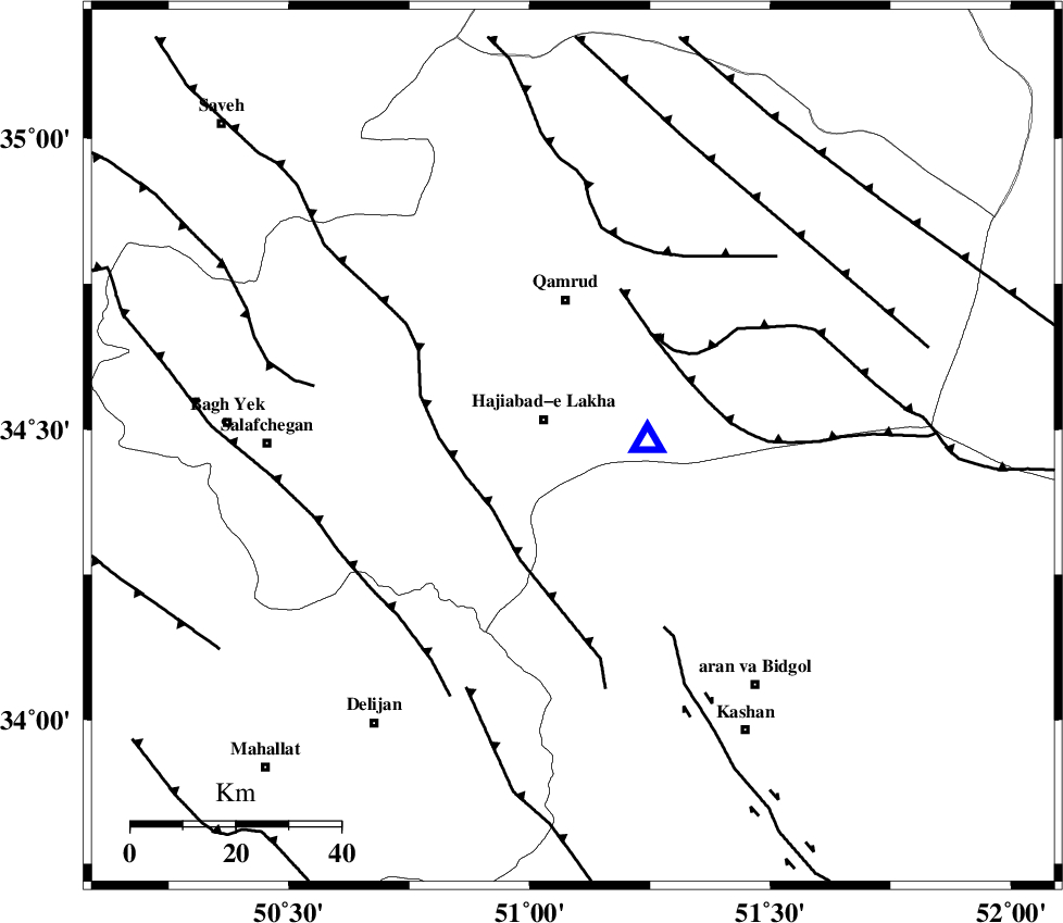
| Location | Lat:34.47 Lon: 51.09 |
| Region | |
Nearest Cities |
|
| 8 km of Hajiabad-e lakha, Qom Province | |
| 22 km North East of Kahak, Qom Province | |
| 27 km North of Yahyaabad, Esfahan Province | |
| 28 km South of Qamrud, Qom Province | |
| 29 km South East of Qom, Qom Province | |
| Depth | 14 km |
| Agency | |
Faults within 150 km: |
|
| KUSHK_E_NOSRAT_F (Length: 230 km) , Distance to epicenter: 36 km | |
| KASHAN_F (Length: 44 km) , Distance to epicenter: 39 km | |
| INDES_F (Length: 98 km) , Distance to epicenter: 51 km | |
| Number of Phases | 7 |
| RMS | 0.2 |
| Number of Stations | 4 |
| Error in Latitude | >1.6 km |
| Error in Longitude | 1.7 km |
| Error in Depth | 6.9 km |
Download waveform in seisan format
to download seisan software Click here
to access information about IIEES stations Click here
Amplitude | ||||||||
| UID | Agency | Station | Component | Amplitude | Period | Arrival Time | Proccessing Time | Signal Clip |
| 5492 | IIEES | DAMV | E | 1067.6 | 0.24 | 2005-04-10 17:33:48 | 2005-07-05 05:11:00 | n |
| 5493 | IIEES | DAMV | N | 1159.3 | 0.22 | 2005-04-10 17:33:48 | 2005-07-05 05:11:00 | n |
| 5494 | IIEES | NASN | N | 200.4 | 0.27 | 2005-04-10 17:34:12 | 2005-07-05 05:11:00 | n |
| 5495 | IIEES | NASN | E | 182.2 | 0.44 | 2005-04-10 17:34:12 | 2005-07-05 05:11:00 | n |
Phase | ||||||||||||
| Agency | Station | Component | Phase Type | Phase Quality | First Motion | Observed Arrival Time | Time Residual | Loc. Flag | Input Weight | Distance | Azimuth | |
| IIEES | ASAO | Z | PG | E | 2005-04-10 17:33:17 | 0.1 | y | 97.79 | 276 | |||
| IIEES | ASAO | N | SG | E | 2005-04-10 17:33:29 | -0.2 | y | 97.79 | 276 | |||
| IIEES | DAMV | Z | PG | E | 2005-04-10 17:33:26 | 0 | y | 152.3 | 32 | |||
| IIEES | DAMV | E | SG | E | 2005-04-10 17:33:44 | 0 | y | 152.3 | 32 | |||
| IIEES | NASN | Z | PG | E | 2005-04-10 17:33:40 | -0.3 | y | 244.4 | 139 | |||
| IIEES | NASN | E | SG | E | 2005-04-10 17:34:10 | 0.2 | y | 244.4 | 139 | |||
| IIEES | SNGE | Z | PN | E | 2005-04-10 17:33:52 | 0.3 | y | 349.2 | 283 | |||