
Magnitude |
:3.7 |
| Date & Time (UTC) | 2005-03-06 00:29:38.7 |
| Date & Time (Local) | 1383/12/16 03:59:38.7 |
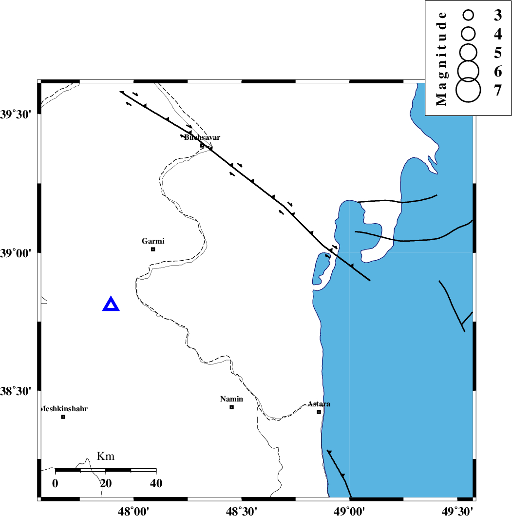
| Location | Lat:38.86 Lon: 48.57 |
| Region | |
Nearest Cities |
|
| 34 km South East of Hasan khanlu, Ardebil Province | |
| 38 km North East of Lurun, Ardebil Province | |
| 42 km North East of Anbaran, Ardebil Province | |
| 43 km South East of Seyyedzahra, Ardebil Province | |
| 45 km South East of Germi, Ardebil Province | |
| Depth | 28 km |
| Agency | |
Faults within 150 km: |
|
| TALESH_F (Length: 258 km) , Distance to epicenter: 10 km | |
| DASHT_E_MOGHAN__ (Length: 104 km) , Distance to epicenter: 62 km | |
| SANGAVAR_F (Length: 61 km) , Distance to epicenter: 72 km | |
| Number of Phases | 6 |
| RMS | 0.1 |
| Number of Stations | 4 |
| Error in Latitude | >6.1 km |
| Error in Longitude | 5.4 km |
| Error in Depth | 4.5 km |
Download waveform in seisan format
to download seisan software Click here
to access information about IIEES stations Click here
Amplitude | ||||||||
| UID | Agency | Station | Component | Amplitude | Period | Arrival Time | Proccessing Time | Signal Clip |
| 5185 | IIEES | GRMI | E | 11740.1 | 0.14 | 2005-03-06 00:29:58 | 2005-07-05 05:11:00 | n |
| 5186 | IIEES | MAKU | N | 94.4 | 0.39 | 2005-03-06 00:31:14 | 2005-07-05 05:11:00 | n |
| 5187 | IIEES | DAMV | N | 84.6 | 0.38 | 2005-03-06 00:31:34 | 2005-07-05 05:11:00 | n |
Phase | ||||||||||||
| Agency | Station | Component | Phase Type | Phase Quality | First Motion | Observed Arrival Time | Time Residual | Loc. Flag | Input Weight | Distance | Azimuth | |
| IIEES | GRMI | Z | PG | I | 2005-03-06 00:29:49 | 0.2 | y | 59.2 | 265 | |||
| IIEES | GRMI | N | SG | E | 2005-03-06 00:29:57 | -0.1 | y | 59.2 | 265 | |||
| IIEES | MAKU | Z | PN | E | 2005-03-06 00:30:27 | 0.1 | y | 341 | 281 | |||
| IIEES | MAKU | N | SG | E | 2005-03-06 00:31:12 | -0.1 | y | 341 | 281 | |||
| IIEES | SNGE | Z | PN | E | 2005-03-06 00:30:38 | 0.1 | y | 431.5 | 195 | |||
| IIEES | DAMV | Z | PN | E | 2005-03-06 00:30:43 | -0.2 | y | 467.8 | 139 | |||