
Magnitude |
:3.2 |
| Date & Time (UTC) | 2005-03-05 19:45:04.5 |
| Date & Time (Local) | 1383/12/15 23:15:04.5 |
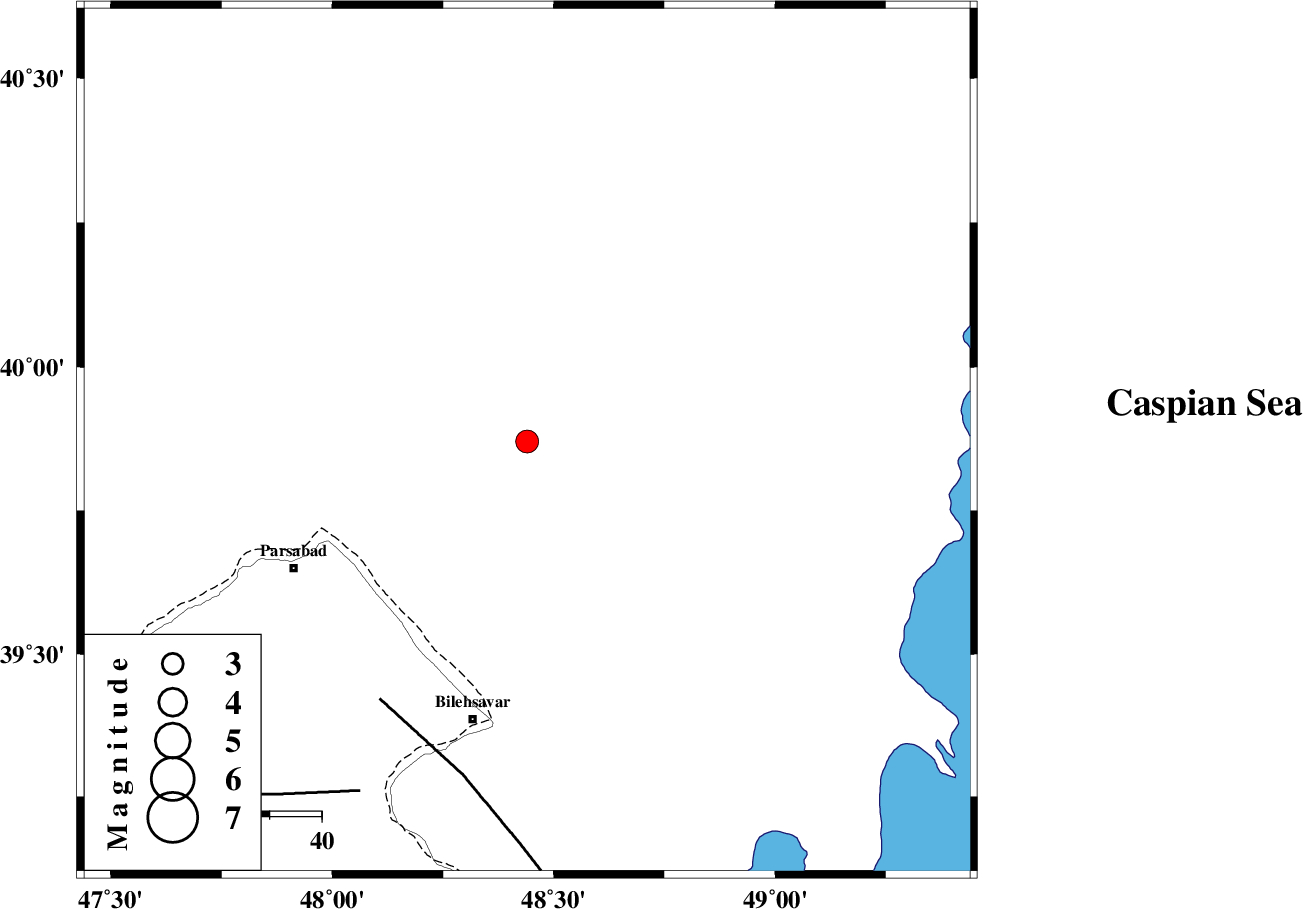
| Location | Lat:39.87 Lon: 48.44 |
| Region | |
Nearest Cities |
|
| 43 km North East of Kushlu, Ardebil Province | |
| 46 km North East of Tazeh kand-e gadim, Ardebil Province | |
| 51 km North East of Pars Abad, Ardebil Province | |
| 55 km North East of Bileh Savar, Ardebil Province | |
| 56 km North East of Jaefarabad, Ardebil Province | |
| Depth | 22 km |
| Agency | |
Faults within 150 km: |
|
| TALESH_F (Length: 258 km) , Distance to epicenter: 57 km | |
| DASHT_E_MOGHAN__ (Length: 104 km) , Distance to epicenter: 75 km | |
| Number of Phases | 4 |
| RMS | 0 |
| Number of Stations | 3 |
| Error in Latitude | >3.8 km |
| Error in Longitude | 6.7 km |
| Error in Depth | 6.2 km |
Download waveform in seisan format
to download seisan software Click here
to access information about IIEES stations Click here
Amplitude | ||||||||
| UID | Agency | Station | Component | Amplitude | Period | Arrival Time | Proccessing Time | Signal Clip |
| 5183 | IIEES | GRMI | N | 1055.4 | 0.2 | 2005-03-05 19:45:42 | 2005-07-05 05:11:00 | n |
| 5184 | IIEES | MAKU | N | 31.5 | 0.52 | 2005-03-05 19:46:49 | 2005-07-05 05:11:00 | n |
Phase | ||||||||||||
| Agency | Station | Component | Phase Type | Phase Quality | First Motion | Observed Arrival Time | Time Residual | Loc. Flag | Input Weight | Distance | Azimuth | |
| IIEES | GRMI | Z | PG | E | 2005-03-05 19:45:25 | 0 | y | 126.4 | 202 | |||
| IIEES | GRMI | E | SG | E | 2005-03-05 19:45:40 | 0 | y | 126.4 | 202 | |||
| IIEES | MAKU | Z | PN | E | 2005-03-05 19:45:52 | 0 | y | 327.3 | 261 | |||
| IIEES | SNGE | Z | PN | E | 2005-03-05 19:46:18 | 0 | y | 538.5 | 191 | |||