
Magnitude |
:3.1 |
| Date & Time (UTC) | 2005-06-18 23:57:05.2 |
| Date & Time (Local) | 1384/3/29 04:27:05.2 |
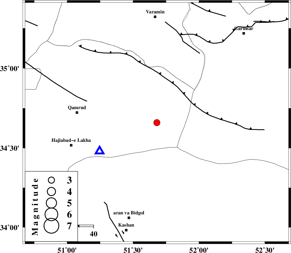
| Location | Lat:34.66 Lon: 51.68 |
| Region | |
Nearest Cities |
|
| 44 km North West of Marnejab, Esfahan Province | |
| 56 km East of Qamrud, Qom Province | |
| 62 km North East of Hajiabad-e lakha, Qom Province | |
| 66 km North East of Nasrabad, Esfahan Province | |
| 67 km North East of Mashgan, Esfahan Province | |
| Depth | 18 km |
| Agency | |
Faults within 150 km: |
|
| SIAHKUH_F (Length: 154 km) , Distance to epicenter: 27 km | |
| KUSHK_E_NOSRAT_F (Length: 230 km) , Distance to epicenter: 51 km | |
| PISHAV_F (Length: 34 km) , Distance to epicenter: 57 km | |
| Number of Phases | 7 |
| RMS | 0.1 |
| Number of Stations | 4 |
| Error in Latitude | >0.9 km |
| Error in Longitude | 1.3 km |
| Error in Depth | 0 km |
Download waveform in seisan format
to download seisan software Click here
to access information about IIEES stations Click here
Amplitude | ||||||||
| UID | Agency | Station | Component | Amplitude | Period | Arrival Time | Proccessing Time | Signal Clip |
| 4290 | IIEES | DAMV | N | 1136 | 0.08 | 2005-06-18 23:57:38 | 2005-07-05 05:11:00 | n |
| 4291 | IIEES | ASAO | E | 297.8 | 0.23 | 2005-06-18 23:57:49 | 2005-07-05 05:11:00 | n |
| 4292 | IIEES | NASN | E | 57 | 0.15 | 2005-06-18 23:58:17 | 2005-07-05 05:11:00 | n |
Phase | ||||||||||||
| Agency | Station | Component | Phase Type | Phase Quality | First Motion | Observed Arrival Time | Time Residual | Loc. Flag | Input Weight | Distance | Azimuth | |
| IIEES | DAMV | Z | PG | E | 2005-06-18 23:57:24 | 0.2 | y | 110.7 | 14 | |||
| IIEES | DAMV | E | SG | E | 2005-06-18 23:57:37 | 0 | y | 110.7 | 14 | |||
| IIEES | ASAO | Z | PG | E | 2005-06-18 23:57:30 | -0.2 | y | 151.9 | 266 | |||
| IIEES | ASAO | N | SG | E | 2005-06-18 23:57:49 | 0.1 | y | 151.9 | 266 | |||
| IIEES | THKV | Z | PG | E | 2005-06-18 23:57:31 | -0.1 | y | 156.8 | 333 | |||
| IIEES | NASN | Z | PG | E | 2005-06-18 23:57:43 | -0.1 | y | 231.8 | 153 | |||
| IIEES | NASN | E | SG | E | 2005-06-18 23:58:11 | 0.1 | y | 231.8 | 153 | |||