
Magnitude |
:2.6 |
| Date & Time (UTC) | 2005-06-15 20:07:05.4 |
| Date & Time (Local) | 1384/3/26 00:37:05.4 |
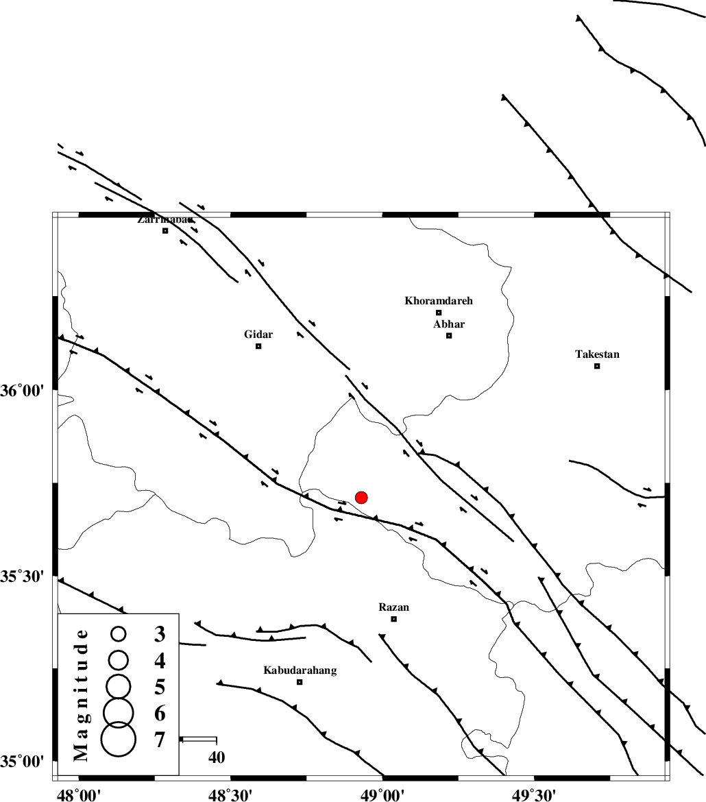
| Location | Lat:35.71 Lon: 48.93 |
| Region | |
Nearest Cities |
|
| 23 km North East of Kahla, Zanjan Province | |
| 24 km North East of Khorandeh, Hamedan Province | |
| 31 km North West of Avaj, Ghazvin Province | |
| 32 km North East of Damag, Hamedan Province | |
| 33 km West of Ab-e garm, Ghazvin Province | |
| Depth | 15 km |
| Agency | |
Faults within 150 km: |
|
| KUSHK_E_NOSRAT_F (Length: 230 km) , Distance to epicenter: 18 km | |
| SOLTANIYEH_F (Length: 119 km) , Distance to epicenter: 37 km | |
| ZANJAN_F (Length: 137 km) , Distance to epicenter: 61 km | |
| Number of Phases | 6 |
| RMS | 0.3 |
| Number of Stations | 5 |
| Error in Latitude | >6.9 km |
| Error in Longitude | 3.4 km |
| Error in Depth | 12 km |
Download waveform in seisan format
to download seisan software Click here
to access information about IIEES stations Click here
Amplitude | ||||||||
| UID | Agency | Station | Component | Amplitude | Period | Arrival Time | Proccessing Time | Signal Clip |
| 4271 | IIEES | DAMV | N | 26.6 | 0.42 | 2005-06-15 20:08:25 | 2005-07-05 05:11:00 | n |
Phase | ||||||||||||
| Agency | Station | Component | Phase Type | Phase Quality | First Motion | Observed Arrival Time | Time Residual | Loc. Flag | Input Weight | Distance | Azimuth | |
| IIEES | SNGE | Z | PG | E | 2005-06-15 20:07:31 | -0.4 | y | 159.1 | 245 | |||
| IIEES | SNGE | E | SG | E | 2005-06-15 20:07:51 | 0.1 | y | 159.1 | 245 | |||
| IIEES | ASAO | Z | PG | E | 2005-06-15 20:07:32 | 0.2 | y | 163 | 142 | |||
| IIEES | THKV | Z | PG | E | 2005-06-15 20:07:34 | -0.5 | y | 177.7 | 82 | |||
| IIEES | DAMV | Z | PN | E | 2005-06-15 20:07:47 | 0.3 | y | 275.5 | 91 | |||
| IIEES | GRMI | Z | PN | E | 2005-06-15 20:07:57 | 0.3 | y | 356.2 | 345 | |||