
Magnitude |
:3.3 |
| Date & Time (UTC) | 2005-06-03 17:59:51.9 |
| Date & Time (Local) | 1384/3/13 22:29:51.9 |
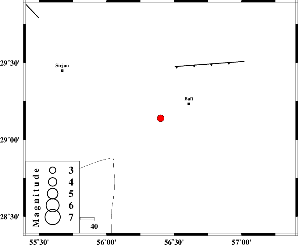
| Location | Lat:29.14 Lon: 56.4 |
| Region | |
Nearest Cities |
|
| 23 km West of Baft, Kerman Province | |
| 29 km North West of Kashkueyeh, Kerman Province | |
| 32 km South West of Bezanjan, Kerman Province | |
| 33 km South West of Karin, Kerman Province | |
| 36 km South of Amirabad, Kerman Province | |
| Depth | 18 km |
| Agency | |
Faults within 150 km: |
|
| LALEHZAR_F (Length: 52 km) , Distance to epicenter: 39 km | |
| RAFSANJAN_F (Length: 129 km) , Distance to epicenter: 84 km | |
| MAIN_ZAGROS_R_F (Length: 1106 km) , Distance to epicenter: 92 km | |
| Number of Phases | 6 |
| RMS | 0.1 |
| Number of Stations | 4 |
| Error in Latitude | >1 km |
| Error in Longitude | 2.8 km |
| Error in Depth | 3.1 km |
Download waveform in seisan format
to download seisan software Click here
to access information about IIEES stations Click here
Amplitude | ||||||||
| UID | Agency | Station | Component | Amplitude | Period | Arrival Time | Proccessing Time | Signal Clip |
| 4193 | IIEES | KRBR | N | 1226.6 | 0.11 | 2005-06-03 18:00:22 | 2005-07-05 05:11:00 | n |
| 4194 | IIEES | BNDS | N | 306.2 | 0.32 | 2005-06-03 18:00:51 | 2005-07-05 05:11:00 | n |
| 4195 | IIEES | GHIR | N | 45.9 | 0.35 | 2005-06-03 18:01:31 | 2005-07-05 05:11:00 | n |
Phase | ||||||||||||
| Agency | Station | Component | Phase Type | Phase Quality | First Motion | Observed Arrival Time | Time Residual | Loc. Flag | Input Weight | Distance | Azimuth | |
| IIEES | KRBR | Z | PG | I | 2005-06-03 18:00:08 | 0 | y | 99.38 | 21 | |||
| IIEES | KRBR | N | SG | E | 2005-06-03 18:00:21 | 0.1 | y | 99.38 | 21 | |||
| IIEES | BNDS | Z | PG | E | 2005-06-03 18:00:23 | -0.1 | y | 194.5 | 187 | |||
| IIEES | BNDS | N | SG | E | 2005-06-03 18:00:47 | 0.1 | y | 194.5 | 187 | |||
| IIEES | GHIR | Z | PN | E | 2005-06-03 18:00:42 | 0 | y | 346.7 | 255 | |||
| IIEES | ZHSF | Z | PN | E | 2005-06-03 18:00:52 | -0.1 | y | 428 | 82 | |||