
Magnitude |
:3.1 |
| Date & Time (UTC) | 2005-06-01 16:08:25.4 |
| Date & Time (Local) | 1384/3/11 20:38:25.4 |
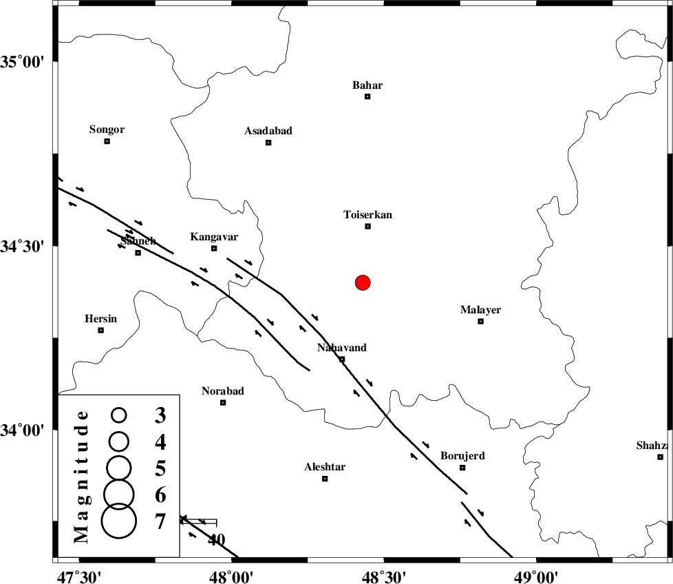
| Location | Lat:34.4 Lon: 48.43 |
| Region | |
Nearest Cities |
|
| 1 km North of Miyandeh, Hamedan Province | |
| 9 km of Seyyed shahab, Hamedan Province | |
| 16 km South of Jaefaryeh, Hamedan Province | |
| 16 km East of Farsang, Hamedan Province | |
| 17 km North of Avarzman, Hamedan Province | |
| Depth | 15 km |
| Agency | |
Faults within 150 km: |
|
| NAHAVAND_F (Length: 102 km) , Distance to epicenter: 20 km | |
| SAHANEH_F (Length: 77 km) , Distance to epicenter: 31 km | |
| DINEHVAR_F (Length: 46 km) , Distance to epicenter: 58 km | |
| Number of Phases | 6 |
| RMS | 0.3 |
| Number of Stations | 4 |
| Error in Latitude | >12.5 km |
| Error in Longitude | 4.9 km |
| Error in Depth | 8.9 km |
Download waveform in seisan format
to download seisan software Click here
to access information about IIEES stations Click here
Amplitude | ||||||||
| UID | Agency | Station | Component | Amplitude | Period | Arrival Time | Proccessing Time | Signal Clip |
| 4168 | IIEES | SNGE | N | 516.7 | 0.48 | 2005-06-01 16:09:09 | 2005-07-05 05:11:00 | n |
| 4169 | IIEES | ASAO | N | 339.9 | 0.52 | 2005-06-01 16:09:11 | 2005-07-05 05:11:00 | n |
| 4170 | IIEES | NASN | N | 19.7 | 0.68 | 2005-06-01 16:10:37 | 2005-07-05 05:11:00 | n |
Phase | ||||||||||||
| Agency | Station | Component | Phase Type | Phase Quality | First Motion | Observed Arrival Time | Time Residual | Loc. Flag | Input Weight | Distance | Azimuth | |
| IIEES | SNGE | Z | PG | E | 2005-06-01 16:08:46 | -0.5 | y | 125.5 | 308 | |||
| IIEES | SNGE | N | SG | E | 2005-06-01 16:09:02 | 0.3 | y | 125.5 | 308 | |||
| IIEES | ASAO | Z | PG | E | 2005-06-01 16:08:50 | -0.2 | y | 147.8 | 83 | |||
| IIEES | ASAO | N | SG | E | 2005-06-01 16:09:08 | -0.1 | y | 147.8 | 83 | |||
| IIEES | DAMV | Z | PN | E | 2005-06-01 16:09:17 | 0.4 | y | 351.2 | 66 | |||
| IIEES | NASN | Z | PN | E | 2005-06-01 16:09:28 | 0.2 | y | 443.5 | 112 | |||