
Magnitude |
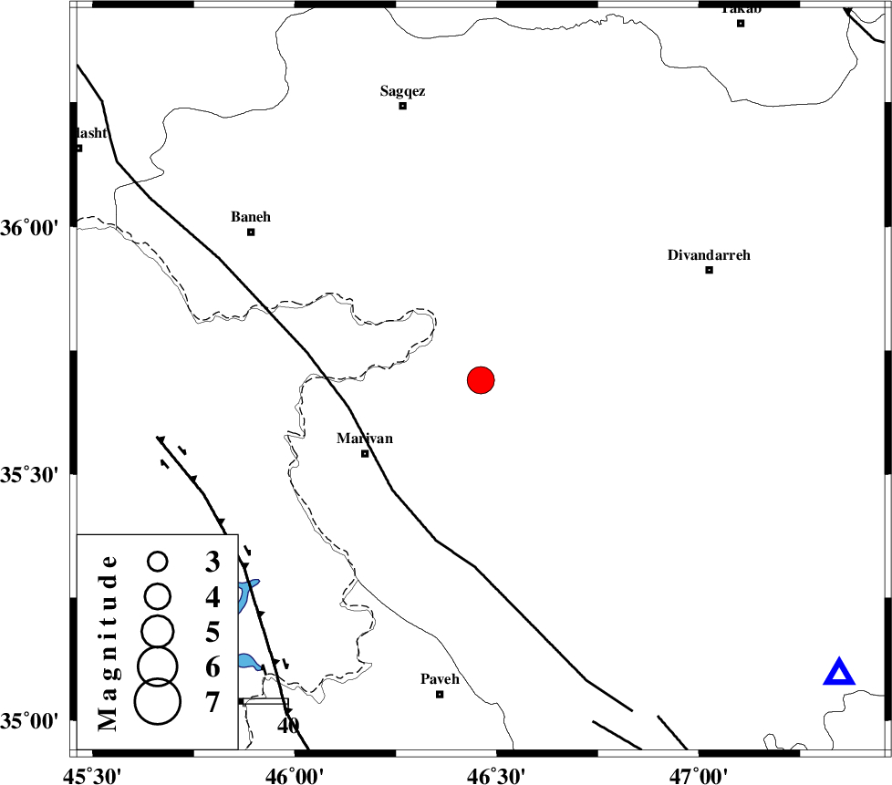
:4.2 |
| Date & Time (UTC) | 2006-03-25 10:12:58.3 |
| Date & Time (Local) | 1385/1/5 13:42:58.3 |
| Location | Lat:35.69 Lon: 46.46 |
| Region | |
Nearest Cities |
|
| 16 km North East of Chenareh, Kurdistan Province | |
| 20 km North of Janevareh, Kurdistan Province | |
| 27 km North of Pir-e khafaran, Kurdistan Province | |
| 31 km North East of Marivan, Kurdistan Province | |
| 33 km West of Hezarkanian, Kurdistan Province | |
| Depth | 18 km |
| Agency | |
Faults within 150 km: |
|
| PIRANSHAHR_F (Length: 253 km) , Distance to epicenter: 30 km | |
| HZF4 (Length: 492 km) , Distance to epicenter: 67 km | |
| SARTAKHT_F (Length: 78 km) , Distance to epicenter: 81 km | |
| Number of Phases | 5 |
| RMS | 0 |
| Number of Stations | 4 |
| Error in Latitude | >3.7 km |
| Error in Longitude | 5.4 km |
| Error in Depth | 5 km |
Download waveform in seisan format
to download seisan software Click here
to access information about IIEES stations Click here
Amplitude | ||||||||
| UID | Agency | Station | Component | Amplitude | Period | Arrival Time | Proccessing Time | Signal Clip |
| 15959 | IIEES | SNGE | E | 10704 | 0.16 | 2006-03-25 10:13:39 | 2006-06-10 03:46:00 | n |
| 15960 | IIEES | SNGE | N | 6311.2 | 0.31 | 2006-03-25 10:13:40 | 2006-06-10 03:46:00 | n |
| 15961 | IIEES | ASAO | N | 454.2 | 1.12 | 2006-03-25 10:14:59 | 2006-06-10 03:46:00 | n |
| 15962 | IIEES | SHGR | N | 302.7 | 0.94 | 2006-03-25 10:15:02 | 2006-06-10 03:46:00 | n |
| 15963 | IIEES | SHGR | E | 410.5 | 0.2 | 2006-03-25 10:15:05 | 2006-06-10 03:46:00 | n |
Phase | ||||||||||||
| Agency | Station | Component | Phase Type | Phase Quality | First Motion | Observed Arrival Time | Time Residual | Loc. Flag | Input Weight | Distance | Azimuth | |
| IIEES | SNGE | Z | PG | E | 2006-03-25 10:13:16 | 0 | y | 104 | 129 | |||
| IIEES | SNGE | N | SG | E | 2006-03-25 10:13:29 | 0 | y | 104 | 129 | |||
| IIEES | ASAO | Z | Pn | E | 2006-03-25 10:13:49 | 0.1 | y | 349 | 110 | |||
| IIEES | CHTH | Z | PN | E | 2006-03-25 10:13:58 | 0 | y | 423 | 85 | |||
| IIEES | SHGR | Z | PN | E | 2006-03-25 10:14:01 | 0 | y | 452 | 151 | |||