
Magnitude |
:3.4 |
| Date & Time (UTC) | 2005-08-13 03:21:37.0 |
| Date & Time (Local) | 1384/5/22 07:51:37.0 |
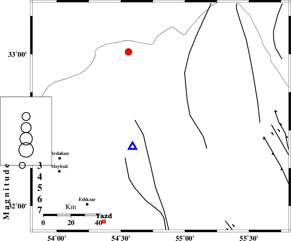
| Location | Lat:32.59 Lon: 54.81 |
| Region | |
Nearest Cities |
|
| 24 km South East of Zarrin, Yazd Province | |
| 31 km North East of Kharaneq, Yazd Province | |
| 38 km North East of Tut, Yazd Province | |
| 57 km South West of Hajiabad, Yazd Province | |
| 80 km North East of Ardakan, Yazd Province | |
| Depth | 14 km |
| Agency | |
Faults within 150 km: |
|
| POSHT_E_BADAM_F (Length: 128 km) , Distance to epicenter: 44 km | |
| ANAR_F (Length: 91 km) , Distance to epicenter: 50 km | |
| ANAR_F (Length: 127 km) , Distance to epicenter: 78 km | |
| Number of Phases | 5 |
| RMS | 0.4 |
| Number of Stations | 4 |
| Error in Latitude | >19.4 km |
| Error in Longitude | 8.2 km |
| Error in Depth | 0 km |
Download waveform in seisan format
to download seisan software Click here
to access information about IIEES stations Click here
Amplitude | ||||||||
| UID | Agency | Station | Component | Amplitude | Period | Arrival Time | Proccessing Time | Signal Clip |
| 9691 | IIEES | NASN | N | 474.1 | 0.52 | 2005-08-13 03:22:35 | 2006-01-09 11:55:00 | n |
| 9692 | IIEES | ASAO | E | 28.1 | 0.65 | 2005-08-13 03:24:07 | 2006-01-09 11:55:00 | n |
Phase | ||||||||||||
| Agency | Station | Component | Phase Type | Phase Quality | First Motion | Observed Arrival Time | Time Residual | Loc. Flag | Input Weight | Distance | Azimuth | |
| IIEES | NASN | Z | PG | E | 2005-08-13 03:22:09 | -0.3 | y | 189 | 278 | |||
| IIEES | NASN | N | SG | E | 2005-08-13 03:22:33 | 0.1 | y | 189 | 278 | |||
| IIEES | DAMV | Z | PN | E | 2005-08-13 03:22:38 | -0.3 | y | 427 | 323 | |||
| IIEES | ASAO | Z | PN | E | 2005-08-13 03:22:47 | 0.7 | y | 495 | 297 | |||
| IIEES | THKV | Z | PN | E | 2005-08-13 03:22:49 | 0 | y | 517 | 317 | |||