
Magnitude |
:2.7 |
| Date & Time (UTC) | 2005-07-30 03:54:39.7 |
| Date & Time (Local) | 1384/5/8 08:24:39.7 |
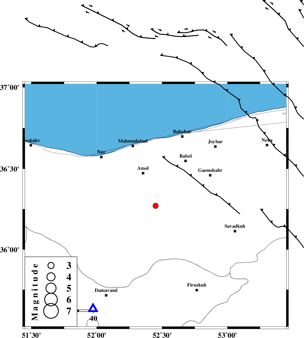
| Location | Lat:36.27 Lon: 52.45 |
| Region | |
Nearest Cities |
|
| 10 km of Razkeh, Mazandaran Province | |
| 14 km of Khoshrud, Mazandaran Province | |
| 18 km South East of Oskumahalleh, Mazandaran Province | |
| 20 km North West of Firoozjah-e sabet, Mazandaran Province | |
| 24 km South of Amol, Mazandaran Province | |
| Depth | 18 km |
| Agency | |
Faults within 150 km: |
|
| N_ALBORZ_F (Length: 360 km) , Distance to epicenter: 9 km | |
| KHAZAR_F (Length: 523 km) , Distance to epicenter: 13 km | |
| KANDOVAN_F (Length: 90 km) , Distance to epicenter: 56 km | |
| Number of Phases | 6 |
| RMS | 0.2 |
| Number of Stations | 5 |
| Error in Latitude | >4.2 km |
| Error in Longitude | 7.2 km |
| Error in Depth | 6.3 km |
Download waveform in seisan format
to download seisan software Click here
to access information about IIEES stations Click here
Amplitude | ||||||||
| UID | Agency | Station | Component | Amplitude | Period | Arrival Time | Proccessing Time | Signal Clip |
| 9577 | IIEES | DAMV | N | 477 | 0.27 | 2005-07-30 03:55:07 | 2006-01-09 11:55:00 | n |
| 9578 | IIEES | ASAO | N | 24.5 | 0.48 | 2005-07-30 03:56:03 | 2006-01-09 11:55:00 | n |
| 9579 | IIEES | SNGE | N | 5 | 0.74 | 2005-07-30 03:56:57 | 2006-01-09 11:55:00 | n |
Phase | ||||||||||||
| Agency | Station | Component | Phase Type | Phase Quality | First Motion | Observed Arrival Time | Time Residual | Loc. Flag | Input Weight | Distance | Azimuth | |
| IIEES | DAMV | Z | PG | E | 2005-07-30 03:54:54 | -0.1 | y | 83.3 | 211 | |||
| IIEES | DAMV | N | SG | E | 2005-07-30 03:55:04 | 0 | y | 83.3 | 211 | |||
| IIEES | THKV | Z | PG | E | 2005-07-30 03:55:04 | 0.1 | y | 147 | 255 | |||
| IIEES | ASAO | Z | PN | E | 2005-07-30 03:55:23 | 0.2 | y | 292 | 230 | |||
| IIEES | NASN | Z | PN | E | 2005-07-30 03:55:35 | 0 | y | 387 | 175 | |||
| IIEES | SNGE | Z | PN | E | 2005-07-30 03:55:46 | -0.3 | y | 480 | 256 | |||