
Magnitude |
:3.2 |
| Date & Time (UTC) | 2025-01-15 22:19:35.4 |
| Date & Time (Local) | 1403/10/27 01:49:35.4 |
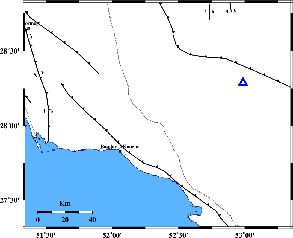
| Location | Lat:28.072 Lon: 52.345 |
| Region | Fars Province, 27 km North of Jam |
Nearest Cities |
|
| 10 km of Dolatabad, Fars Province | |
| 27 km North of Jam, Bushehr Province | |
| 27 km North East of Riz, Bushehr Province | |
| 38 km North West of Garmesht, Fars Province | |
| 39 km North East of Bandar-e kangan, Bushehr Province | |
| Depth | 12 km |
| Agency | |
Faults within 150 km: |
|
| MFF3 (Length: 292 km) , Distance to epicenter: 35 km | |
| QIR_F (Length: 130 km) , Distance to epicenter: 51 km | |
| MFF5 (Length: 74 km) , Distance to epicenter: 53 km | |
| Number of Phases | 6 |
| RMS | 0.7 |
| Number of Stations | 6 |
| Error in Latitude | >3.2 km |
| Error in Longitude | 3.2 km |
| Error in Depth | 14.4 km |
Download waveform in seisan format
to download seisan software Click here
to access information about IIEES stations Click here
Amplitude | ||||||||
| UID | Agency | Station | Component | Amplitude | Period | Arrival Time | Proccessing Time | Signal Clip |
| 199477 | IIEES SC | UOSS | Z | 0.02 | 1 | 2025-01-15 22:20:48 | 2025-10-04 08:58:00 | n |
| 199478 | IIEES SC | YZKH | Z | 0.02 | 1 | 2025-01-15 22:20:49 | 2025-10-04 08:58:00 | n |
| 199479 | IIEES SC | IRSR | Z | 0.006 | 1 | 2025-01-15 22:21:29 | 2025-10-04 08:58:00 | n |
| 199480 | IIEES SC | RAYN | Z | 0.009 | 1 | 2025-01-15 22:21:28 | 2025-10-04 08:58:00 | n |
Phase | ||||||||||||
| Agency | Station | Component | Phase Type | Phase Quality | First Motion | Observed Arrival Time | Time Residual | Loc. Flag | Input Weight | Distance | Azimuth | |
| IIEES SC | GHIR | Z | EPg | E | 2025-01-15 22:19:46 | -1 | y | 0 | 67 | 69 | ||
| IIEES SC | UOSS | Z | EPn | E | 2025-01-15 22:20:48 | 0.9 | y | 0 | 518 | 132 | ||
| IIEES SC | YZKH | Z | EPn | E | 2025-01-15 22:20:49 | 1 | y | 0 | 525 | 24 | ||
| IIEES SC | IRSR | Z | EPn | E | 2025-01-15 22:21:29 | 0 | y | 0 | 850 | 98 | ||
| IIEES SC | RAYN | Z | EPn | E | 2025-01-15 22:21:28 | -0.2 | y | 0 | 851 | 234 | ||
| IIEES SC | SRSL | Z | EPn | E | 2025-01-15 22:22:01 | -0.4 | y | 0 | 1114 | 324 | ||