
Magnitude |
:2.5 |
| Date & Time (UTC) | 2015-12-27 06:24:51.4 |
| Date & Time (Local) | 1394/10/6 09:54:51.4 |
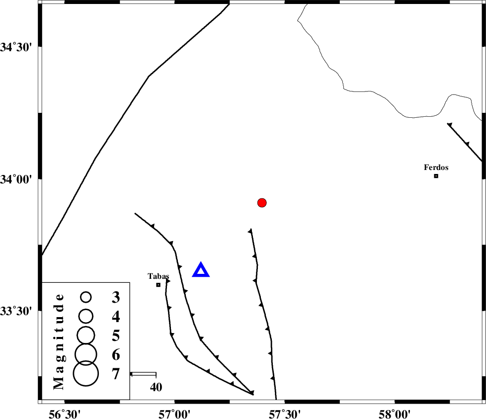
| Location | Lat:33.91 Lon: 57.396 |
| Region | Khorasan(center) Province, 56 km North-East of Tabas |
Nearest Cities |
|
| 5 km North of Boshravieh, Khorasan(center) Province | |
| 15 km South of Qaniabad, Khorasan(center) Province | |
| 16 km North East of Reqqeh, Khorasan(center) Province | |
| 24 km North of Arsak, Khorasan(center) Province | |
| 56 km North East of Tabas, Yazd Province | |
| Depth | 20 km |
| Agency | |
Faults within 150 km: |
|
| ESFARDIAR_F (Length: 94 km) , Distance to epicenter: 12 km | |
| TABAS_F1 (Length: 91 km) , Distance to epicenter: 42 km | |
| TABAS_F2 (Length: 67 km) , Distance to epicenter: 51 km | |
| Number of Phases | 6 |
| RMS | 0.1 |
| Number of Stations | 6 |
| Error in Latitude | >2.2 km |
| Error in Longitude | 2.5 km |
| Error in Depth | 3.8 km |
Download waveform in seisan format
to download seisan software Click here
to access information about IIEES stations Click here
Amplitude | ||||||||
| UID | Agency | Station | Component | Amplitude | Period | Arrival Time | Proccessing Time | Signal Clip |
| 103126 | IIEES | TABS | N | 552.2 | 0.33 | 2015-12-27 06:25:07 | 2015-12-27 07:17:00 | n |
| 103127 | IIEES | YZKH | E | 13.1 | 0.33 | 2015-12-27 06:26:25 | 2015-12-27 07:17:00 | n |
Phase | ||||||||||||
| Agency | Station | Component | Phase Type | Phase Quality | First Motion | Observed Arrival Time | Time Residual | Loc. Flag | Input Weight | Distance | Azimuth | |
| IIEES | TABS | Z | Pg | E | 2015-12-27 06:24:58 | 0 | y | 38.7 | 222 | |||
| IIEES | SHRO | Z | Pn | E | 2015-12-27 06:25:31 | -0.08 | y | 265 | 332 | |||
| IIEES | BSRN | Z | Pn | E | 2015-12-27 06:25:32 | -0.04 | y | 270 | 143 | |||
| IIEES | SHRT | Z | Pn | E | 2015-12-27 06:25:32 | 0.1 | y | 270 | 95 | |||
| IIEES | YZKH | Z | Pn | E | 2015-12-27 06:25:37 | 0.15 | y | 311 | 238 | |||
| IIEES | KRBR | Z | Pn | E | 2015-12-27 06:25:53 | -0.15 | y | 440 | 188 | |||