
Magnitude |
:2.7 |
| Date & Time (UTC) | 2015-10-24 21:18:31.8 |
| Date & Time (Local) | 1394/8/3 00:48:31.8 |
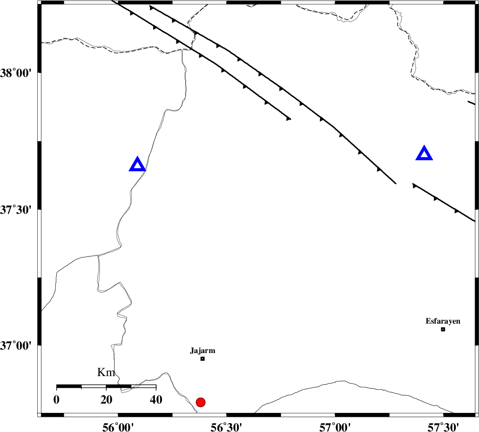
| Location | Lat:37.499 Lon: 56.645 |
| Region | Khorasan(north) Province, 27 km -West of Ashkhaneh |
Nearest Cities |
|
| 24 km North West of Shogan, Khorasan(north) Province | |
| 27 km West of Ashkhaneh, Khorasan(north) Province | |
| 36 km South West of Pish qaleh, Khorasan(north) Province | |
| 39 km South East of Garmab, Khorasan(north) Province | |
| 57 km South West of Tangehzar, Khorasan(north) Province | |
| Depth | 14 km |
| Agency | |
Faults within 150 km: |
|
| ROBATE_QARABIL_F (Length: 168 km) , Distance to epicenter: 17 km | |
| ESFARAYEN_F (Length: 111 km) , Distance to epicenter: 35 km | |
| JAJARAM_F (Length: 77 km) , Distance to epicenter: 48 km | |
| Number of Phases | 6 |
| RMS | 0.2 |
| Number of Stations | 4 |
| Error in Latitude | >1.8 km |
| Error in Longitude | 2.3 km |
| Error in Depth | 7.1 km |
Download waveform in seisan format
to download seisan software Click here
to access information about IIEES stations Click here
Amplitude | ||||||||
| UID | Agency | Station | Component | Amplitude | Period | Arrival Time | Proccessing Time | Signal Clip |
| 102020 | IIEES | MRVT | N | 346.8 | 0.19 | 2015-10-24 21:18:49 | 2015-10-25 11:28:00 | n |
| 102021 | IIEES | MRVT | E | 309.3 | 0.14 | 2015-10-24 21:18:49 | 2015-10-25 11:28:00 | n |
| 102022 | IIEES | TABS | N | 22 | 0.75 | 2015-10-24 21:20:49 | 2015-10-25 11:28:00 | n |
| 102023 | IIEES | TABS | E | 14.9 | 0.67 | 2015-10-24 21:20:51 | 2015-10-25 11:28:00 | n |
Phase | ||||||||||||
| Agency | Station | Component | Phase Type | Phase Quality | First Motion | Observed Arrival Time | Time Residual | Loc. Flag | Input Weight | Distance | Azimuth | |
| IIEES | MRVT | Z | Pg | E | 2015-10-24 21:18:41 | -0.18 | y | 52.2 | 290 | |||
| IIEES | MRVT | N | Sg | E | 2015-10-24 21:18:48 | 0.13 | y | 52.2 | 290 | |||
| IIEES | BJRD | Z | Pg | E | 2015-10-24 21:18:44 | -0.1 | y | 71 | 71 | |||
| IIEES | SHRO | Z | Pg | E | 2015-10-24 21:19:00 | 0.08 | y | 175 | 199 | |||
| IIEES | SHRO | N | Sg | E | 2015-10-24 21:19:21 | -0.2 | y | 175 | 199 | |||
| IIEES | TABS | Z | Pn | E | 2015-10-24 21:19:33 | 0.36 | y | 429 | 174 | |||