
Magnitude |
:2.6 |
| Date & Time (UTC) | 2015-10-17 22:23:20.1 |
| Date & Time (Local) | 1394/7/26 01:53:20.1 |
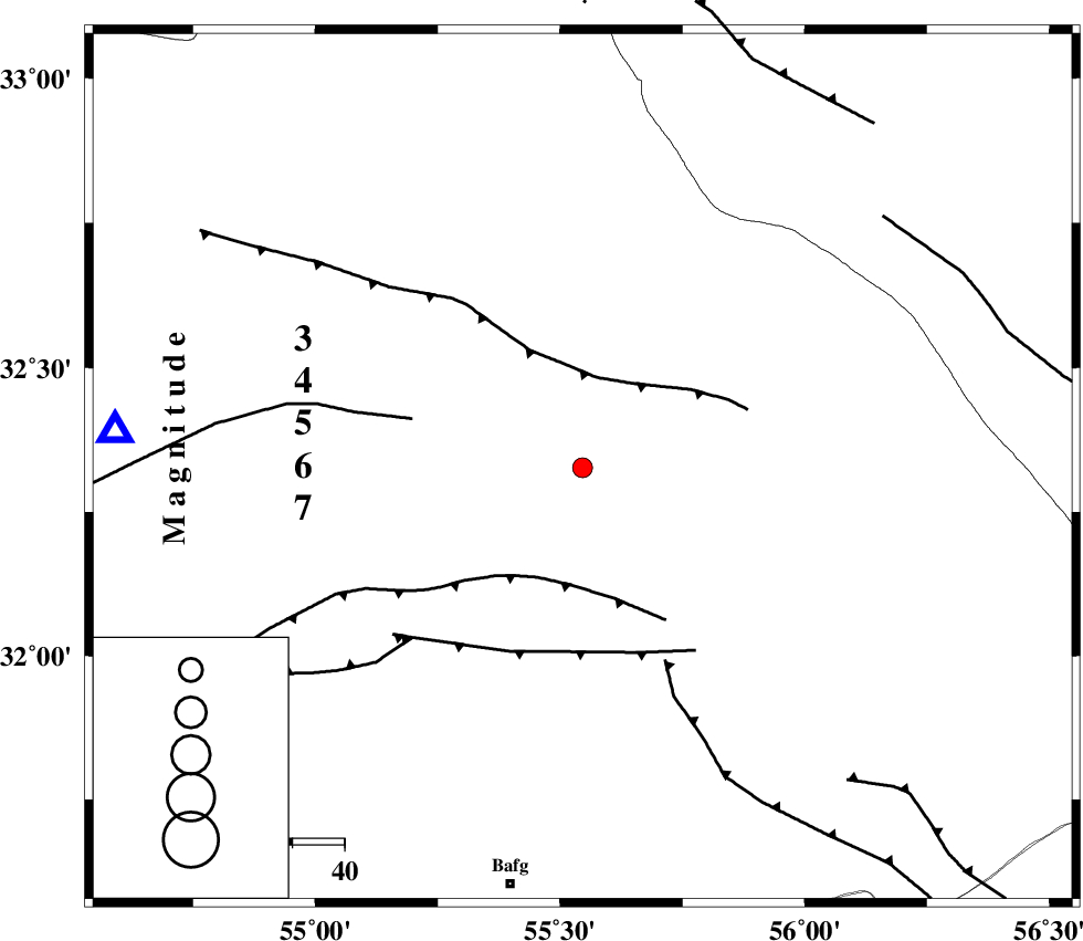
| Location | Lat:32.327 Lon: 55.546 |
| Region | Yazd Province, 82 km North-East of Bafq |
Nearest Cities |
|
| 68 km North West of Behabad, Yazd Province | |
| 69 km North West of Kushk, Yazd Province | |
| 77 km South of Robat-e posht-e badam, Yazd Province | |
| 79 km North East of Mobarake, Yazd Province | |
| 82 km North East of Bafq, Yazd Province | |
| Depth | 14 km |
| Agency | |
Faults within 150 km: |
|
| SARBALA_F (Length: 92 km) , Distance to epicenter: 25 km | |
| POSHT_E_BADAM_F (Length: 128 km) , Distance to epicenter: 27 km | |
| JAFARABAD_F (Length: 60 km) , Distance to epicenter: 40 km | |
| Number of Phases | 6 |
| RMS | 0.3 |
| Number of Stations | 4 |
| Error in Latitude | >4.4 km |
| Error in Longitude | 4.3 km |
| Error in Depth | 9.6 km |
Download waveform in seisan format
to download seisan software Click here
to access information about IIEES stations Click here
Amplitude | ||||||||
| UID | Agency | Station | Component | Amplitude | Period | Arrival Time | Proccessing Time | Signal Clip |
| 101822 | IIEES | YZKH | N | 223.4 | 0.21 | 2015-10-17 22:23:49 | 2015-10-18 07:24:00 | n |
Phase | ||||||||||||
| Agency | Station | Component | Phase Type | Phase Quality | First Motion | Observed Arrival Time | Time Residual | Loc. Flag | Input Weight | Distance | Azimuth | |
| IIEES | YZKH | Z | Pg | E | 2015-10-17 22:23:35 | 0.13 | y | 90.1 | 275 | |||
| IIEES | YZKH | N | Sg | E | 2015-10-17 22:23:46 | -0.38 | y | 90.1 | 275 | |||
| IIEES | TABS | Z | Pn | E | 2015-10-17 22:23:53 | -0.26 | y | 208 | 45 | |||
| IIEES | NASN | Z | Pn | E | 2015-10-17 22:24:01 | 0.44 | y | 262 | 282 | |||
| IIEES | KRBR | Z | Pn | E | 2015-10-17 22:24:03 | 0.29 | y | 285 | 156 | |||
| IIEES | KRBR | N | Sg | E | 2015-10-17 22:24:40 | -0.21 | y | 285 | 156 | |||