
Magnitude |
:2.5 |
| Date & Time (UTC) | 2015-10-02 04:27:25.4 |
| Date & Time (Local) | 1394/7/10 07:57:25.4 |
| Location | Lat:35.764 Lon: 52.103 |
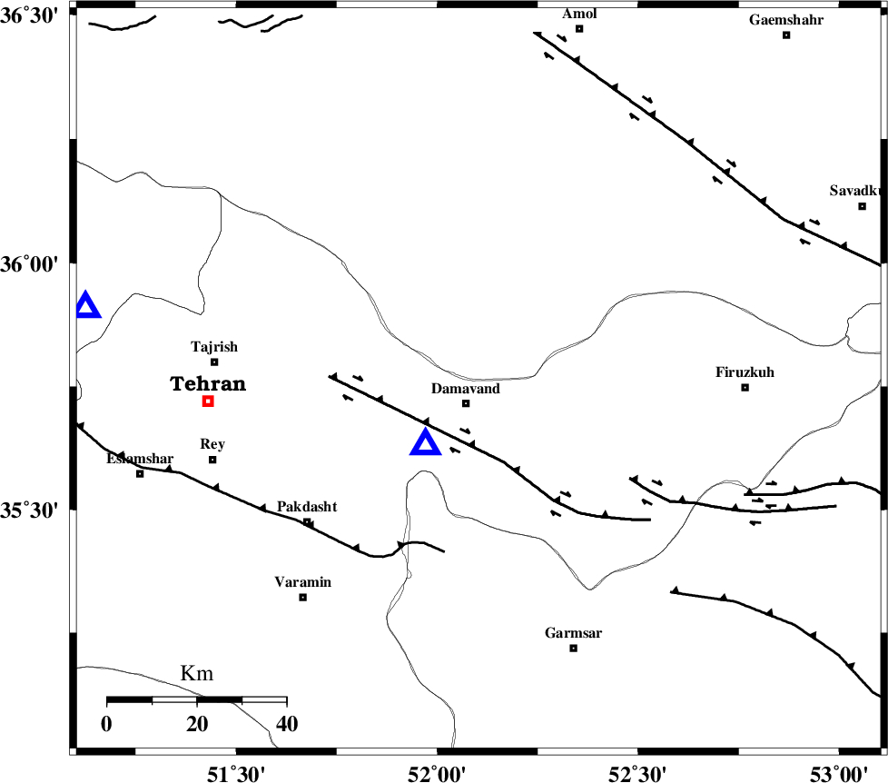
| Region | Mazandaran Province, 6 km of Damavand |
Nearest Cities |
|
| 6 km North of Damavand, Tehran Province | |
| 9 km of Abali, Tehran Province | |
| 15 km South of Rineh, Mazandaran Province | |
| 15 km North of Ab sard, Tehran Province | |
| 17 km North of Mara, Tehran Province | |
| Depth | 14 km |
| Agency | |
Faults within 150 km: |
|
| MOSHA_F (Length: 234 km) , Distance to epicenter: 4 km | |
| N_TEHRAN_F4 (Length: 115 km) , Distance to epicenter: 30 km | |
| EYVANEKEY_F (Length: 74 km) , Distance to epicenter: 42 km | |
| Number of Phases | 7 |
| RMS | 0.4 |
| Number of Stations | 5 |
| Error in Latitude | >5.7 km |
| Error in Longitude | 8.3 km |
| Error in Depth | 8.4 km |
Download waveform in seisan format
to download seisan software Click here
to access information about IIEES stations Click here
Amplitude | ||||||||
| UID | Agency | Station | Component | Amplitude | Period | Arrival Time | Proccessing Time | Signal Clip |
| 101364 | IIEES | THKV | N | 62.2 | 0.27 | 2015-10-02 04:27:59 | 2015-10-03 11:52:00 | n |
| 101365 | IIEES | ASAO | N | 61.8 | 0.27 | 2015-10-02 04:28:37 | 2015-10-03 11:52:00 | n |
Phase | ||||||||||||
| Agency | Station | Component | Phase Type | Phase Quality | First Motion | Observed Arrival Time | Time Residual | Loc. Flag | Input Weight | Distance | Azimuth | |
| IIEES | DAMV | Z | Pg | E | 2015-10-02 04:27:29 | -0.68 | y | 19.1 | 219 | |||
| IIEES | CHTH | Z | Pg | E | 2015-10-02 04:27:41 | 0.41 | y | 89.7 | 281 | |||
| IIEES | CHTH | E | Sg | E | 2015-10-02 04:27:52 | -0.01 | y | 89.7 | 281 | |||
| IIEES | THKV | Z | Pg | E | 2015-10-02 04:27:43 | -0.48 | y | 112 | 279 | |||
| IIEES | GHVR | Z | Pg | E | 2015-10-02 04:27:52 | 0.26 | y | 162 | 209 | |||
| IIEES | ASAO | Z | Pn | E | 2015-10-02 04:28:02 | 0.53 | y | 232 | 235 | |||
| IIEES | ASAO | N | Sg | E | 2015-10-02 04:28:31 | -0.02 | y | 232 | 235 | |||