
Magnitude |
:2.7 |
| Date & Time (UTC) | 2015-10-01 12:17:03.3 |
| Date & Time (Local) | 1394/7/9 15:47:03.3 |
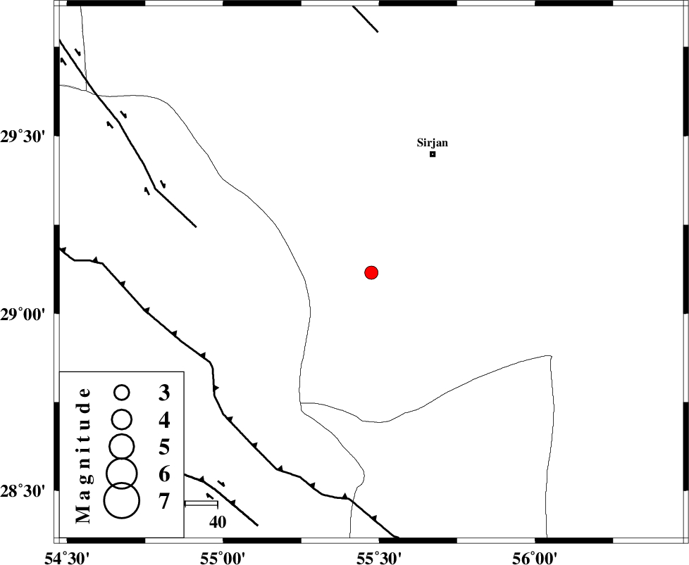
| Location | Lat:29.115 Lon: 55.475 |
| Region | Kerman Province, 42 km South-West of Sirjan |
Nearest Cities |
|
| 38 km South West of Najafabad, Kerman Province | |
| 39 km South West of Malekabad, Kerman Province | |
| 39 km South West of Sharifabad, Kerman Province | |
| 42 km South West of Sirjan, Kerman Province | |
| 49 km South West of Mahmud Abad, Kerman Province | |
| Depth | 16 km |
| Agency | |
Faults within 150 km: |
|
| SHAHR_E_BABAK_F1 (Length: 392 km) , Distance to epicenter: 56 km | |
| MAIN_ZAGROS_R_F (Length: 1106 km) , Distance to epicenter: 58 km | |
| SHAHR_E_BABAK_F2 (Length: 272 km) , Distance to epicenter: 75 km | |
| Number of Phases | 5 |
| RMS | 0.1 |
| Number of Stations | 4 |
| Error in Latitude | >2 km |
| Error in Longitude | 5.1 km |
| Error in Depth | 7.4 km |
Download waveform in seisan format
to download seisan software Click here
to access information about IIEES stations Click here
Amplitude | ||||||||
| UID | Agency | Station | Component | Amplitude | Period | Arrival Time | Proccessing Time | Signal Clip |
| 101347 | IIEES | KRBR | E | 63.4 | 0.53 | 2015-10-01 12:17:54 | 2015-10-03 11:52:00 | n |
| 101348 | IIEES | BNDS | E | 119.9 | 0.43 | 2015-10-01 12:18:10 | 2015-10-03 11:52:00 | n |
| 101349 | IIEES | YZKH | E | 18.5 | 0.57 | 2015-10-01 12:18:58 | 2015-10-03 11:52:00 | n |
| 101350 | IIEES | YZKH | N | 18.4 | 0.41 | 2015-10-01 12:19:05 | 2015-10-03 11:52:00 | n |
| 101351 | IIEES | BSRN | E | 5.2 | 0.6 | 2015-10-01 12:19:26 | 2015-10-03 11:52:00 | n |
Phase | ||||||||||||
| Agency | Station | Component | Phase Type | Phase Quality | First Motion | Observed Arrival Time | Time Residual | Loc. Flag | Input Weight | Distance | Azimuth | |
| IIEES | KRBR | Z | Pg | E | 2015-10-01 12:17:29 | -0.16 | y | 157 | 52 | |||
| IIEES | KRBR | N | Sg | E | 2015-10-01 12:17:48 | 0.13 | y | 157 | 52 | |||
| IIEES | BNDS | Z | P | E | 2015-10-01 12:17:36 | 0.05 | y | 202 | 160 | |||
| IIEES | YZKH | Z | Pn | E | 2015-10-01 12:17:57 | 0.09 | y | 373 | 347 | |||
| IIEES | BSRN | Z | Pn | E | 2015-10-01 12:18:09 | -0.13 | y | 472 | 47 | |||