
Magnitude |
:2.3 |
| Date & Time (UTC) | 2015-09-30 10:41:07.8 |
| Date & Time (Local) | 1394/7/8 14:11:07.8 |
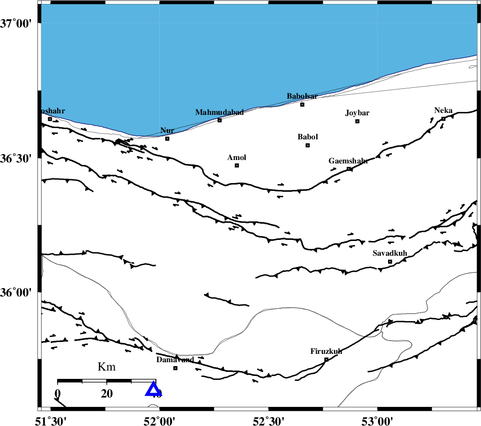
| Location | Lat:36.319 Lon: 52.457 |
| Region | Mazandaran Province, 19 km South-East of Amol |
Nearest Cities |
|
| 9 km of Razkeh, Mazandaran Province | |
| 10 km of Khoshrud, Mazandaran Province | |
| 14 km East of Oskumahalleh, Mazandaran Province | |
| 19 km South East of Amol, Mazandaran Province | |
| 21 km South West of Paeen-e ahmad chalehpey, Mazandaran Province | |
| Depth | 14 km |
| Agency | |
Faults within 150 km: |
|
| KHAZAR_F (Length: 523 km) , Distance to epicenter: 7 km | |
| N_ALBORZ_F (Length: 360 km) , Distance to epicenter: 11 km | |
| KANDOVAN_F (Length: 90 km) , Distance to epicenter: 58 km | |
| Number of Phases | 6 |
| RMS | 0.1 |
| Number of Stations | 5 |
| Error in Latitude | >2.6 km |
| Error in Longitude | 8.2 km |
| Error in Depth | 5.1 km |
Download waveform in seisan format
to download seisan software Click here
to access information about IIEES stations Click here
Amplitude | ||||||||
| UID | Agency | Station | Component | Amplitude | Period | Arrival Time | Proccessing Time | Signal Clip |
| 101316 | IIEES | GHVR | N | 22.3 | 0.47 | 2015-09-30 10:42:19 | 2015-09-30 11:41:00 | n |
| 101317 | IIEES | GHVR | E | 17.9 | 0.33 | 2015-09-30 10:42:19 | 2015-09-30 11:41:00 | n |
Phase | ||||||||||||
| Agency | Station | Component | Phase Type | Phase Quality | First Motion | Observed Arrival Time | Time Residual | Loc. Flag | Input Weight | Distance | Azimuth | |
| IIEES | DAMV | Z | Pg | E | 2015-09-30 10:41:22 | -0.11 | y | 88.1 | 210 | |||
| IIEES | CHTH | Z | Pg | E | 2015-09-30 10:41:29 | 0.1 | y | 128 | 250 | |||
| IIEES | THKV | Z | Pg | E | 2015-09-30 10:41:32 | -0.14 | y | 149 | 253 | |||
| IIEES | GHVR | Z | Pn | E | 2015-09-30 10:41:44 | 0 | y | 232 | 209 | |||
| IIEES | GHVR | E | Sg | E | 2015-09-30 10:42:13 | 0.03 | y | 232 | 209 | |||
| IIEES | ASAO | Z | Pn | E | 2015-09-30 10:41:52 | 0.14 | y | 296 | 229 | |||