
Magnitude |
:2.7 |
| Date & Time (UTC) | 2015-09-17 01:15:38.3 |
| Date & Time (Local) | 1394/6/26 05:45:38.3 |
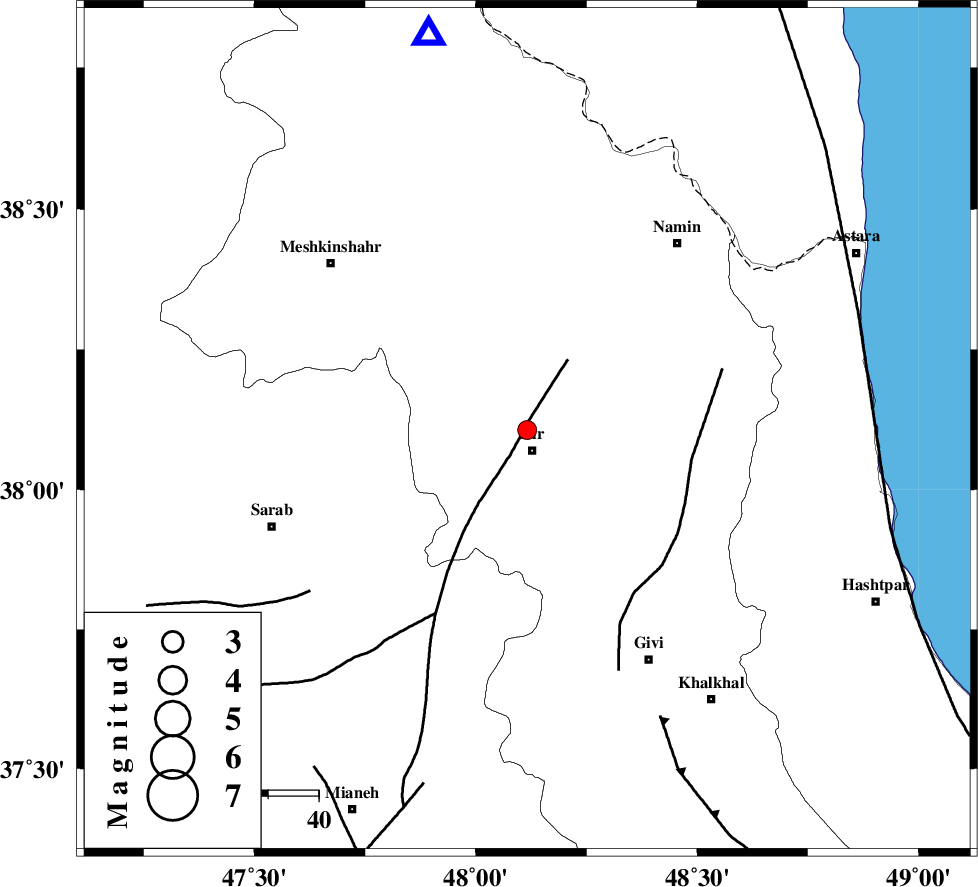
| Location | Lat:38.106 Lon: 48.116 |
| Region | Ardebil Province, 4 km of Nir |
Nearest Cities |
|
| 2 km of Rezaqoli qeshlaq, Ardebil Province | |
| 4 km North of Nir, Ardebil Province | |
| 6 km of Varniab, Ardebil Province | |
| 6 km of Eslamabad, Ardebil Province | |
| 9 km of Sareyin, Ardebil Province | |
| Depth | 20 km |
| Agency | |
Faults within 150 km: |
|
| BOZQUSH (Length: 70 km) , Distance to epicenter: 16 km | |
| SANGAVAR_F (Length: 61 km) , Distance to epicenter: 33 km | |
| MASULEL_F (Length: 90 km) , Distance to epicenter: 63 km | |
| Number of Phases | 5 |
| RMS | 0.5 |
| Number of Stations | 3 |
| Error in Latitude | >999.9 km |
| Error in Longitude | 999.9 km |
| Error in Depth | 999.9 km |
Download waveform in seisan format
to download seisan software Click here
to access information about IIEES stations Click here
Amplitude | ||||||||
| UID | Agency | Station | Component | Amplitude | Period | Arrival Time | Proccessing Time | Signal Clip |
| 101304 | IIEES | GRMI | E | 151.9 | 0.19 | 2015-09-17 01:16:04 | 2015-09-30 11:06:00 | n |
| 101305 | IIEES | GRMI | N | 450.4 | 0.19 | 2015-09-17 01:16:04 | 2015-09-30 11:06:00 | n |
| 101306 | IIEES | ZNJK | N | 121.7 | 0.24 | 2015-09-17 01:16:31 | 2015-09-30 11:06:00 | n |
Phase | ||||||||||||
| Agency | Station | Component | Phase Type | Phase Quality | First Motion | Observed Arrival Time | Time Residual | Loc. Flag | Input Weight | Distance | Azimuth | |
| IIEES | GRMI | Z | Pg | E | 2015-09-17 01:15:52 | 0.69 | y | 80.5 | 346 | |||
| IIEES | GRMI | N | Sg | E | 2015-09-17 01:16:01 | -0.65 | y | 80.5 | 346 | |||
| IIEES | ZNJK | Z | Pg | E | 2015-09-17 01:16:06 | 0.47 | y | 167 | 162 | |||
| IIEES | ZNJK | E | Sg | E | 2015-09-17 01:16:24 | -0.47 | y | 167 | 162 | |||
| IIEES | MAKU | Z | Pn | E | 2015-09-17 01:16:26 | -0.05 | y | 329 | 296 | |||