
Magnitude |
:2.2 |
| Date & Time (UTC) | 2015-09-27 12:49:37.6 |
| Date & Time (Local) | 1394/7/5 16:19:37.6 |
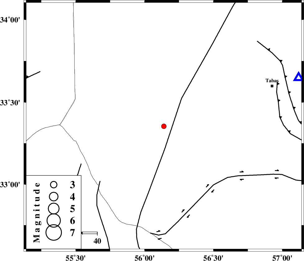
| Location | Lat:33.354 Lon: 56.14 |
| Region | Yazd Province, 78 km South-West of Tabas |
Nearest Cities |
|
| 35 km South of Darin, Yazd Province | |
| 66 km North East of Robat-e posht-e badam, Yazd Province | |
| 67 km South West of Halvan, Yazd Province | |
| 73 km South West of Jokhvah, Yazd Province | |
| 74 km West of Kerit, Yazd Province | |
| Depth | 22 km |
| Agency | |
Faults within 150 km: |
|
| NAINI_F (Length: 342 km) , Distance to epicenter: 15 km | |
| CHESHMEH_ROSTAM_ (Length: 142 km) , Distance to epicenter: 52 km | |
| SARBALA_F (Length: 92 km) , Distance to epicenter: 57 km | |
| Number of Phases | 5 |
| RMS | 0.1 |
| Number of Stations | 5 |
| Error in Latitude | >2.4 km |
| Error in Longitude | 2 km |
| Error in Depth | 3.6 km |
Download waveform in seisan format
to download seisan software Click here
to access information about IIEES stations Click here
Amplitude | ||||||||
| UID | Agency | Station | Component | Amplitude | Period | Arrival Time | Proccessing Time | Signal Clip |
| 101191 | IIEES | YZKH | N | 33.7 | 0.43 | 2015-09-27 12:50:36 | 2015-09-28 07:33:00 | n |
| 101192 | IIEES | YZKH | E | 24.9 | 0.3 | 2015-09-27 12:50:37 | 2015-09-28 07:33:00 | n |
Phase | ||||||||||||
| Agency | Station | Component | Phase Type | Phase Quality | First Motion | Observed Arrival Time | Time Residual | Loc. Flag | Input Weight | Distance | Azimuth | |
| IIEES | TABS | Z | Pg | E | 2015-09-27 12:49:54 | 0.07 | y | 96.7 | 70 | |||
| IIEES | YZKH | Z | Pg | E | 2015-09-27 12:50:06 | -0.08 | y | 180 | 234 | |||
| IIEES | SHRO | Z | Pn | E | 2015-09-27 12:50:21 | -0.09 | y | 295 | 358 | |||
| IIEES | NASN | Z | Pn | E | 2015-09-27 12:50:24 | 0.14 | y | 317 | 260 | |||
| IIEES | BSRN | Z | Pn | E | 2015-09-27 12:50:24 | -0.04 | y | 320 | 118 | |||