
Magnitude |
:2.7 |
| Date & Time (UTC) | 2015-09-22 09:08:56.7 |
| Date & Time (Local) | 1394/6/31 12:38:56.7 |
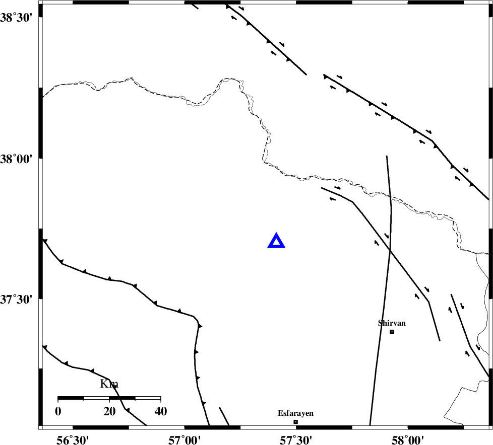
| Location | Lat:37.795 Lon: 57.363 |
| Region | Khorasan(north) Province, 36 km North of Bojnurd |
Nearest Cities |
|
| 16 km South West of Gifan olia, Khorasan(north) Province | |
| 26 km South East of Raz, Khorasan(north) Province | |
| 33 km North West of Hesar-egarmkhanh, Khorasan(north) Province | |
| 34 km North West of Yangi ghale-ye bala, Khorasan(north) Province | |
| 35 km North East of Pish qaleh, Khorasan(north) Province | |
| Depth | 14 km |
| Agency | |
Faults within 150 km: |
|
| BAGHAN_GERMAB_F (Length: 79 km) , Distance to epicenter: 25 km | |
| MAIN_KOPEHDAGH_F2 (Length: 131 km) , Distance to epicenter: 58 km | |
| ROBATE_QARABIL_F (Length: 168 km) , Distance to epicenter: 59 km | |
| Number of Phases | 5 |
| RMS | 0.4 |
| Number of Stations | 4 |
| Error in Latitude | >6.2 km |
| Error in Longitude | 6.5 km |
| Error in Depth | 5.6 km |
Download waveform in seisan format
to download seisan software Click here
to access information about IIEES stations Click here
Amplitude | ||||||||
| UID | Agency | Station | Component | Amplitude | Period | Arrival Time | Proccessing Time | Signal Clip |
| 101104 | IIEES | BJRD | E | 3197.3 | 0.18 | 2015-09-22 09:09:02 | 2015-09-23 07:31:00 | n |
| 101105 | IIEES | MRVT | N | 144.5 | 0.23 | 2015-09-22 09:09:33 | 2015-09-23 07:31:00 | n |
| 101106 | IIEES | MRVT | E | 166.3 | 0.23 | 2015-09-22 09:09:35 | 2015-09-23 07:31:00 | n |
Phase | ||||||||||||
| Agency | Station | Component | Phase Type | Phase Quality | First Motion | Observed Arrival Time | Time Residual | Loc. Flag | Input Weight | Distance | Azimuth | |
| IIEES | BJRD | Z | Pg | E | 2015-09-22 09:08:59 | -0.3 | y | 11.3 | 159 | |||
| IIEES | MRVT | Z | Pg | E | 2015-09-22 09:09:15 | -0.22 | y | 113 | 263 | |||
| IIEES | SHRO | Z | Pn | E | 2015-09-22 09:09:33 | 0.71 | y | 232 | 212 | |||
| IIEES | SHRO | E | Sg | E | 2015-09-22 09:10:02 | -0.18 | y | 232 | 212 | |||
| IIEES | SHRT | Z | Pn | E | 2015-09-22 09:10:10 | -0.02 | y | 531 | 149 | |||