
Magnitude |
:2.9 |
| Date & Time (UTC) | 2015-09-18 16:04:57.6 |
| Date & Time (Local) | 1394/6/27 20:34:57.6 |
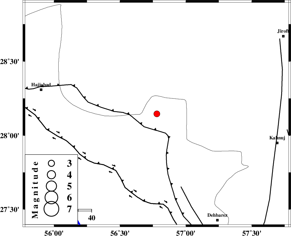
| Location | Lat:28.146 Lon: 56.78 |
| Region | Hormozgan Province, 88 km South-East of Hajiabad |
Nearest Cities |
|
| 24 km South of Sarkhan, Kerman Province | |
| 49 km North West of Faryab, Kerman Province | |
| 52 km South East of Shahmaran, Kerman Province | |
| 52 km South East of Arzuieeh, Kerman Province | |
| 53 km West of Hurpasefid, Kerman Province | |
| Depth | 15 km |
| Agency | |
Faults within 150 km: |
|
| MAIN_ZAGROS_R_F (Length: 1106 km) , Distance to epicenter: 12 km | |
| HZF2 (Length: 437 km) , Distance to epicenter: 52 km | |
| ZENDAN_MINAB_F_Z1 (Length: 183 km) , Distance to epicenter: 58 km | |
| Number of Phases | 5 |
| RMS | 0.1 |
| Number of Stations | 4 |
| Error in Latitude | >2.1 km |
| Error in Longitude | 7.7 km |
| Error in Depth | 4.9 km |
Download waveform in seisan format
to download seisan software Click here
to access information about IIEES stations Click here
Amplitude | ||||||||
| UID | Agency | Station | Component | Amplitude | Period | Arrival Time | Proccessing Time | Signal Clip |
| 100989 | IIEES | KRBR | N | 61.5 | 0.41 | 2015-09-18 16:06:01 | 2015-09-19 08:32:00 | n |
| 100990 | IIEES | BSRN | E | 16.7 | 0.52 | 2015-09-18 16:07:15 | 2015-09-19 08:32:00 | n |
| 100991 | IIEES | BSRN | N | 16.9 | 0.67 | 2015-09-18 16:07:20 | 2015-09-19 08:32:00 | n |
Phase | ||||||||||||
| Agency | Station | Component | Phase Type | Phase Quality | First Motion | Observed Arrival Time | Time Residual | Loc. Flag | Input Weight | Distance | Azimuth | |
| IIEES | BNDS | Z | Pg | E | 2015-09-18 16:05:15 | 0.01 | y | 102 | 216 | |||
| IIEES | KRBR | Z | Pn | E | 2015-09-18 16:05:30 | 0.2 | y | 203 | 359 | |||
| IIEES | KRBR | N | Sg | E | 2015-09-18 16:05:55 | -0.01 | y | 203 | 359 | |||
| IIEES | BSRN | Z | Pn | E | 2015-09-18 16:06:04 | -0.12 | y | 480 | 28 | |||
| IIEES | YZKH | Z | Pn | E | 2015-09-18 16:06:09 | -0.18 | y | 515 | 336 | |||