
Magnitude |
:2.3 |
| Date & Time (UTC) | 2015-09-18 19:27:04.5 |
| Date & Time (Local) | 1394/6/27 23:57:04.5 |
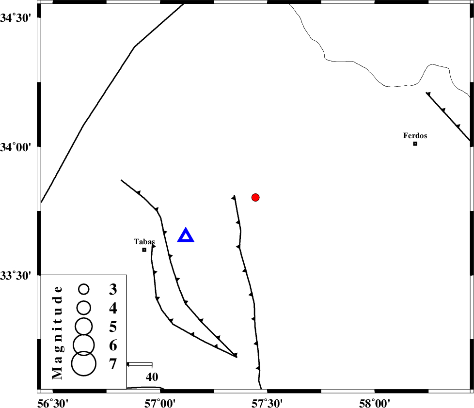
| Location | Lat:33.803 Lon: 57.444 |
| Region | Khorasan(center) Province, 53 km North-East of Tabas |
Nearest Cities |
|
| 7 km of Boshravieh, Khorasan(center) Province | |
| 13 km North of Arsak, Khorasan(center) Province | |
| 17 km East of Reqqeh, Khorasan(center) Province | |
| 28 km South of Qaniabad, Khorasan(center) Province | |
| 53 km North East of Tabas, Yazd Province | |
| Depth | 15 km |
| Agency | |
Faults within 150 km: |
|
| ESFARDIAR_F (Length: 94 km) , Distance to epicenter: 9 km | |
| TABAS_F1 (Length: 91 km) , Distance to epicenter: 42 km | |
| TABAS_F2 (Length: 67 km) , Distance to epicenter: 49 km | |
| Number of Phases | 4 |
| RMS | 0.4 |
| Number of Stations | 4 |
| Error in Latitude | >5.5 km |
| Error in Longitude | 3.3 km |
| Error in Depth | 0 km |
Download waveform in seisan format
to download seisan software Click here
to access information about IIEES stations Click here
Amplitude | ||||||||
| UID | Agency | Station | Component | Amplitude | Period | Arrival Time | Proccessing Time | Signal Clip |
| 100982 | IIEES | BSRN | E | 20.1 | 0.36 | 2015-09-18 19:28:22 | 2015-09-19 08:14:00 | n |
| 100983 | IIEES | BSRN | N | 12.8 | 0.24 | 2015-09-18 19:28:24 | 2015-09-19 08:14:00 | n |
Phase | ||||||||||||
| Agency | Station | Component | Phase Type | Phase Quality | First Motion | Observed Arrival Time | Time Residual | Loc. Flag | Input Weight | Distance | Azimuth | |
| IIEES | BSRN | Z | Pn | E | 2015-09-18 19:27:43 | -0.51 | y | 258 | 142 | |||
| IIEES | SHRT | Z | Pn | E | 2015-09-18 19:27:45 | 0.46 | y | 264 | 93 | |||
| IIEES | SHRO | Z | Pn | E | 2015-09-18 19:27:46 | -0.26 | y | 277 | 332 | |||
| IIEES | YZKH | Z | Pn | E | 2015-09-18 19:27:51 | 0.33 | y | 309 | 240 | |||