
Magnitude |
:3.6 |
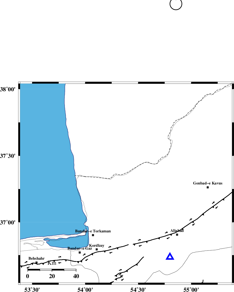
| Date & Time (UTC) | 2015-09-18 15:56:21.6 |
| Date & Time (Local) | 1394/6/27 20:26:21.6 |
| Location | Lat:37.29 Lon: 54.386 |
| Region | Golestan Province, 31 km North of Aq Qaleh |
Nearest Cities |
|
| 31 km North of Aq Qaleh, Golestan Province | |
| 33 km North West of Qanqarmeh, Golestan Province | |
| 34 km North East of Banavar, Golestan Province | |
| 34 km North East of Gomishtappeh, Golestan Province | |
| 35 km South West of Enchehborun, Golestan Province | |
| Depth | 18 km |
| Agency | |
Faults within 150 km: |
|
| KHAZAR_F (Length: 523 km) , Distance to epicenter: 50 km | |
| N_ALBORZ_F (Length: 360 km) , Distance to epicenter: 76 km | |
| SHAVAR_F (Length: 87 km) , Distance to epicenter: 80 km | |
| Number of Phases | 6 |
| RMS | 0.1 |
| Number of Stations | 4 |
| Error in Latitude | >1.8 km |
| Error in Longitude | 2.9 km |
| Error in Depth | 5.9 km |
Download waveform in seisan format
to download seisan software Click here
to access information about IIEES stations Click here
Amplitude | ||||||||
| UID | Agency | Station | Component | Amplitude | Period | Arrival Time | Proccessing Time | Signal Clip |
| 100955 | IIEES | MRVT | E | 1159.8 | 0.31 | 2015-09-18 15:57:13 | 2015-09-19 06:07:00 | n |
| 100956 | IIEES | SHRO | N | 484 | 0.31 | 2015-09-18 15:57:26 | 2015-09-19 06:07:00 | n |
| 100957 | IIEES | SHRO | E | 877 | 0.66 | 2015-09-18 15:57:33 | 2015-09-19 06:07:00 | n |
| 100958 | IIEES | GHVR | E | 49.1 | 0.65 | 2015-09-18 15:58:25 | 2015-09-19 06:07:00 | n |
Phase | ||||||||||||
| Agency | Station | Component | Phase Type | Phase Quality | First Motion | Observed Arrival Time | Time Residual | Loc. Flag | Input Weight | Distance | Azimuth | |
| IIEES | MRVT | Z | Pg | E | 2015-09-18 15:56:47 | 0.05 | y | 156 | 74 | |||
| IIEES | MRVT | E | Sg | E | 2015-09-18 15:57:06 | 0.01 | y | 156 | 74 | |||
| IIEES | SHRO | Z | Pn | E | 2015-09-18 15:56:54 | -0.21 | y | 203 | 134 | |||
| IIEES | SHRO | E | Sg | E | 2015-09-18 15:57:19 | 0.08 | y | 203 | 134 | |||
| IIEES | DAMV | Z | Pn | E | 2015-09-18 15:57:04 | 0.06 | y | 284 | 230 | |||
| IIEES | GHVR | Z | Pn | E | 2015-09-18 15:57:21 | 0.02 | y | 421 | 223 | |||