
Magnitude |
:2.2 |
| Date & Time (UTC) | 2015-09-06 02:36:39.0 |
| Date & Time (Local) | 1394/6/15 07:06:39.0 |
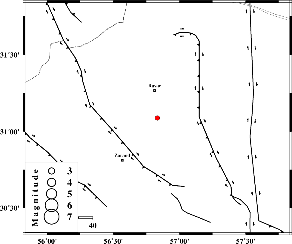
| Location | Lat:31.088 Lon: 56.833 |
| Region | Kerman Province, 20 km South of Ravar |
Nearest Cities |
|
| 20 km South of Ravar, Kerman Province | |
| 21 km North East of Ahmadi, Kerman Province | |
| 26 km North East of Dasht-e khak, Kerman Province | |
| 26 km South of Dehali, Kerman Province | |
| 27 km North of Hatkan, Kerman Province | |
| Depth | 14 km |
| Agency | |
Faults within 150 km: |
|
| LAKARKUH_F (Length: 138 km) , Distance to epicenter: 30 km | |
| KUHBANAN_F (Length: 189 km) , Distance to epicenter: 33 km | |
| CHATRUD_F (Length: 37 km) , Distance to epicenter: 56 km | |
| Number of Phases | 5 |
| RMS | 0.2 |
| Number of Stations | 3 |
| Error in Latitude | >2.7 km |
| Error in Longitude | 4.4 km |
| Error in Depth | 8.9 km |
Download waveform in seisan format
to download seisan software Click here
to access information about IIEES stations Click here
Amplitude | ||||||||
| UID | Agency | Station | Component | Amplitude | Period | Arrival Time | Proccessing Time | Signal Clip |
| 100733 | IIEES | KRBR | N | 48.9 | 0.33 | 2015-09-06 02:37:17 | 2015-09-06 06:33:00 | n |
| 100734 | IIEES | YZKH | E | 12.5 | 0.48 | 2015-09-06 02:37:55 | 2015-09-06 06:33:00 | n |
| 100735 | IIEES | YZKH | N | 12.8 | 0.66 | 2015-09-06 02:37:58 | 2015-09-06 06:33:00 | n |
Phase | ||||||||||||
| Agency | Station | Component | Phase Type | Phase Quality | First Motion | Observed Arrival Time | Time Residual | Loc. Flag | Input Weight | Distance | Azimuth | |
| IIEES | KRBR | Z | Pg | E | 2015-09-06 02:37:00 | 0.26 | y | 123 | 183 | |||
| IIEES | KRBR | N | Sg | E | 2015-09-06 02:37:14 | -0.17 | y | 123 | 183 | |||
| IIEES | BSRN | Z | Pn | E | 2015-09-06 02:37:16 | -0.16 | y | 239 | 65 | |||
| IIEES | YZKH | Z | Pn | E | 2015-09-06 02:37:19 | 0.22 | y | 257 | 305 | |||
| IIEES | YZKH | N | Sg | E | 2015-09-06 02:37:51 | -0.15 | y | 257 | 305 | |||