
Magnitude |
:2.6 |
| Date & Time (UTC) | 2015-08-29 07:45:02.0 |
| Date & Time (Local) | 1394/6/7 12:15:02.0 |
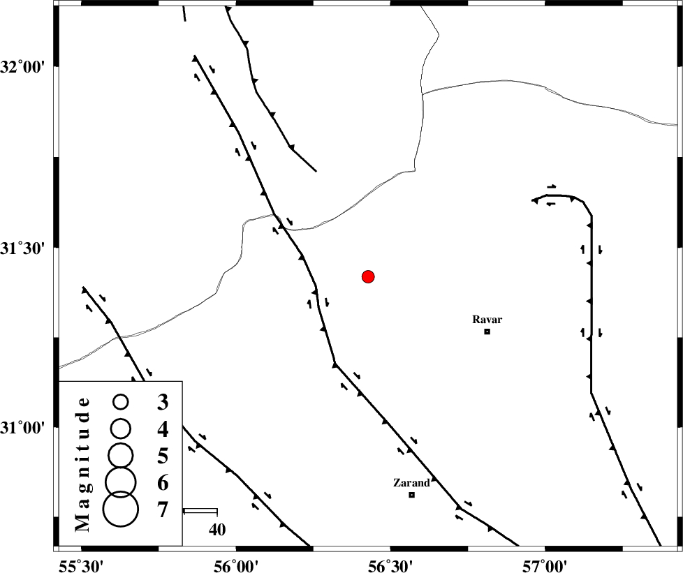
| Location | Lat:31.418 Lon: 56.427 |
| Region | Kerman Province, 40 km North-West of Ravar |
Nearest Cities |
|
| 13 km North East of Kuhbanan, Kerman Province | |
| 15 km North East of Jor, Kerman Province | |
| 30 km North of Toghroljerd, Kerman Province | |
| 34 km South East of Asfih, Yazd Province | |
| 37 km North West of Dehali, Kerman Province | |
| Depth | 14 km |
| Agency | |
Faults within 150 km: |
|
| KUHBANAN_F (Length: 189 km) , Distance to epicenter: 16 km | |
| JAFARABAD_F (Length: 60 km) , Distance to epicenter: 36 km | |
| LAKARKUH_F (Length: 138 km) , Distance to epicenter: 55 km | |
| Number of Phases | 4 |
| RMS | 0 |
| Number of Stations | 3 |
| Error in Latitude | >2.7 km |
| Error in Longitude | 2.1 km |
| Error in Depth | 5.7 km |
Download waveform in seisan format
to download seisan software Click here
to access information about IIEES stations Click here
Amplitude | ||||||||
| UID | Agency | Station | Component | Amplitude | Period | Arrival Time | Proccessing Time | Signal Clip |
| 100575 | IIEES | YZKH | E | 48.4 | 0.46 | 2015-08-29 07:46:03 | 2015-08-30 07:50:00 | n |
| 100576 | IIEES | YZKH | N | 58.4 | 0.63 | 2015-08-29 07:46:03 | 2015-08-30 07:50:00 | n |
Phase | ||||||||||||
| Agency | Station | Component | Phase Type | Phase Quality | First Motion | Observed Arrival Time | Time Residual | Loc. Flag | Input Weight | Distance | Azimuth | |
| IIEES | KRBR | Z | Pg | E | 2015-08-29 07:45:29 | 0 | y | 162 | 169 | |||
| IIEES | YZKH | Z | Pn | E | 2015-08-29 07:45:35 | -0.01 | y | 204 | 302 | |||
| IIEES | BSRN | Z | Pn | E | 2015-08-29 07:45:42 | 0.01 | y | 263 | 76 | |||
| IIEES | BSRN | N | Sg | E | 2015-08-29 07:46:16 | -0.01 | y | 263 | 76 | |||