
Magnitude |
:3.5 |
| Date & Time (UTC) | 2015-08-27 05:28:48.4 |
| Date & Time (Local) | 1394/6/5 09:58:48.4 |
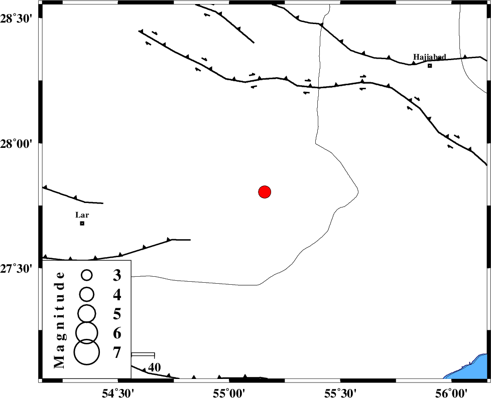
| Location | Lat:27.804 Lon: 55.159 |
| Region | Fars Province, 82 km North-East of Lar |
Nearest Cities |
|
| 27 km West of Darz, Fars Province | |
| 45 km South of Fadami, Fars Province | |
| 56 km South of Doborji, Fars Province | |
| 72 km South of Rostaq, Fars Province | |
| 73 km East of Dehkuyeh, Fars Province | |
| Depth | 16 km |
| Agency | |
Faults within 150 km: |
|
| LAR_F (Length: 99 km) , Distance to epicenter: 39 km | |
| HZF2 (Length: 437 km) , Distance to epicenter: 49 km | |
| HZF1 (Length: 102 km) , Distance to epicenter: 66 km | |
| Number of Phases | 5 |
| RMS | 0.2 |
| Number of Stations | 4 |
| Error in Latitude | >2.5 km |
| Error in Longitude | 4.9 km |
| Error in Depth | 9 km |
Download waveform in seisan format
to download seisan software Click here
to access information about IIEES stations Click here
Amplitude | ||||||||
| UID | Agency | Station | Component | Amplitude | Period | Arrival Time | Proccessing Time | Signal Clip |
| 100564 | IIEES | KRBR | E | 184.9 | 0.78 | 2015-08-27 05:30:24 | 2015-08-29 11:24:00 | n |
Phase | ||||||||||||
| Agency | Station | Component | Phase Type | Phase Quality | First Motion | Observed Arrival Time | Time Residual | Loc. Flag | Input Weight | Distance | Azimuth | |
| IIEES | BNDS | Z | Pg | E | 2015-08-27 05:29:06 | -0.04 | y | 110 | 114 | |||
| IIEES | KRBR | Z | Pn | E | 2015-08-27 05:29:32 | 0.1 | y | 288 | 33 | |||
| IIEES | KRBR | N | Sg | E | 2015-08-27 05:30:09 | 0.05 | y | 288 | 33 | |||
| IIEES | AHRM | Z | Pn | E | 2015-08-27 05:29:45 | 0.19 | y | 397 | 288 | |||
| IIEES | NASN | Z | Pn | E | 2015-08-27 05:30:10 | -0.45 | y | 598 | 338 | |||