
Magnitude |
:2.6 |
| Date & Time (UTC) | 2015-08-21 17:31:29.3 |
| Date & Time (Local) | 1394/5/30 22:01:29.3 |
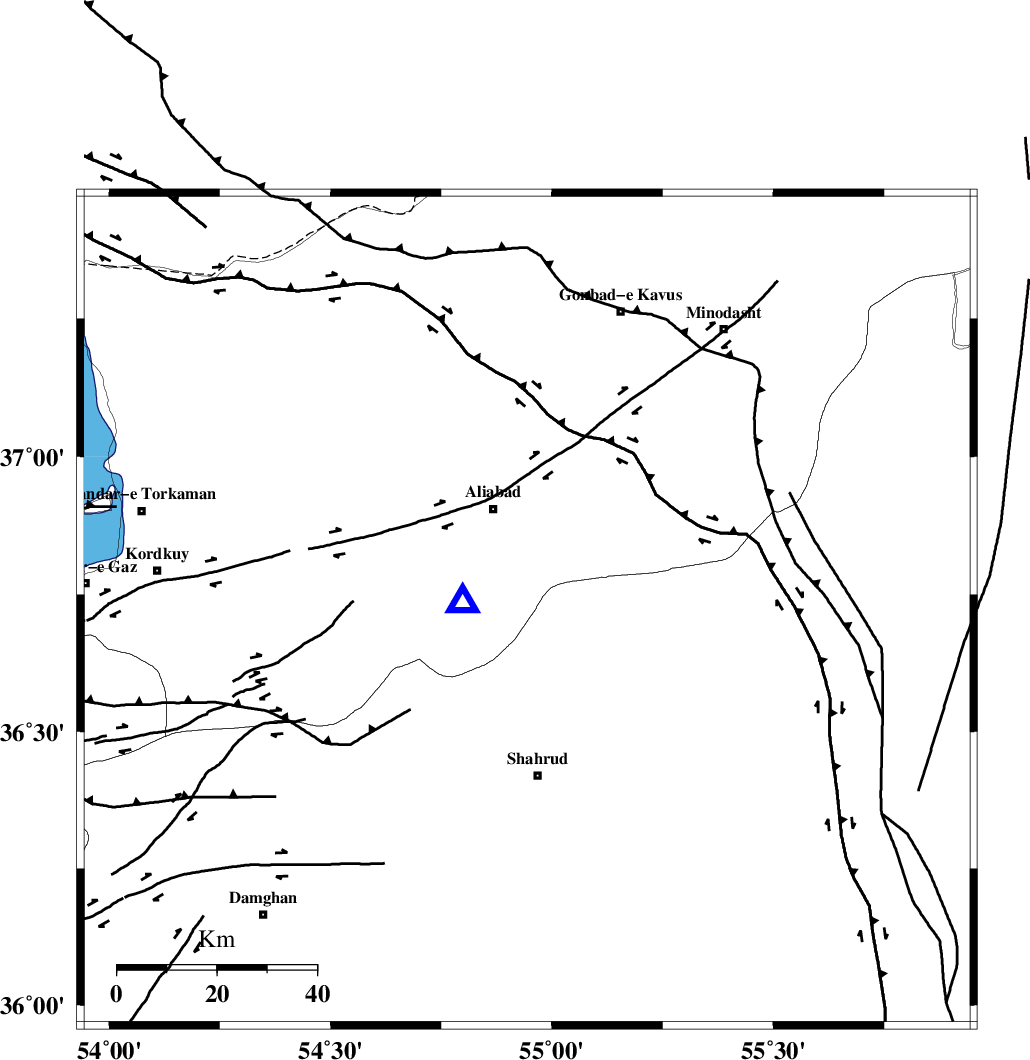
| Location | Lat:36.72 Lon: 54.944 |
| Region | Golestan Province, 22 km South of Ali Abad |
Nearest Cities |
|
| 17 km North West of Qaleh-ye nokharqan, Semnan Province | |
| 22 km South of Ali Abad, Golestan Province | |
| 27 km North of Bastam, Semnan Province | |
| 33 km South of Khanbebin, Golestan Province | |
| 33 km North West of Kalateh khanj, Semnan Province | |
| Depth | 16 km |
| Agency | |
Faults within 150 km: |
|
| SHAVAR_F (Length: 87 km) , Distance to epicenter: 12 km | |
| KHAZAR_F (Length: 523 km) , Distance to epicenter: 32 km | |
| ASTANEH_F (Length: 72 km) , Distance to epicenter: 40 km | |
| Number of Phases | 5 |
| RMS | 0.2 |
| Number of Stations | 5 |
| Error in Latitude | >2.8 km |
| Error in Longitude | 4 km |
| Error in Depth | 5.6 km |
Download waveform in seisan format
to download seisan software Click here
to access information about IIEES stations Click here
Amplitude | ||||||||
| UID | Agency | Station | Component | Amplitude | Period | Arrival Time | Proccessing Time | Signal Clip |
| 100418 | IIEES | SHRO | N | 113.7 | 0.27 | 2015-08-21 17:32:12 | 2015-08-22 08:41:00 | n |
| 100419 | IIEES | SHRO | E | 139.8 | 0.18 | 2015-08-21 17:32:15 | 2015-08-22 08:41:00 | n |
Phase | ||||||||||||
| Agency | Station | Component | Phase Type | Phase Quality | First Motion | Observed Arrival Time | Time Residual | Loc. Flag | Input Weight | Distance | Azimuth | |
| IIEES | SHRO | Z | Pg | E | 2015-08-21 17:31:50 | -0.15 | y | 124 | 129 | |||
| IIEES | MRVT | Z | Pg | E | 2015-08-21 17:31:53 | 0.15 | y | 146 | 44 | |||
| IIEES | BJRD | Z | Pn | E | 2015-08-21 17:32:07 | -0.17 | y | 244 | 63 | |||
| IIEES | DAMV | Z | Pn | E | 2015-08-21 17:32:13 | -0.06 | y | 294 | 247 | |||
| IIEES | TABS | Z | Pn | E | 2015-08-21 17:32:26 | 0.29 | y | 394 | 149 | |||