
Magnitude |
:2.7 |
| Date & Time (UTC) | 2015-08-17 20:37:20.0 |
| Date & Time (Local) | 1394/5/27 01:07:20.0 |
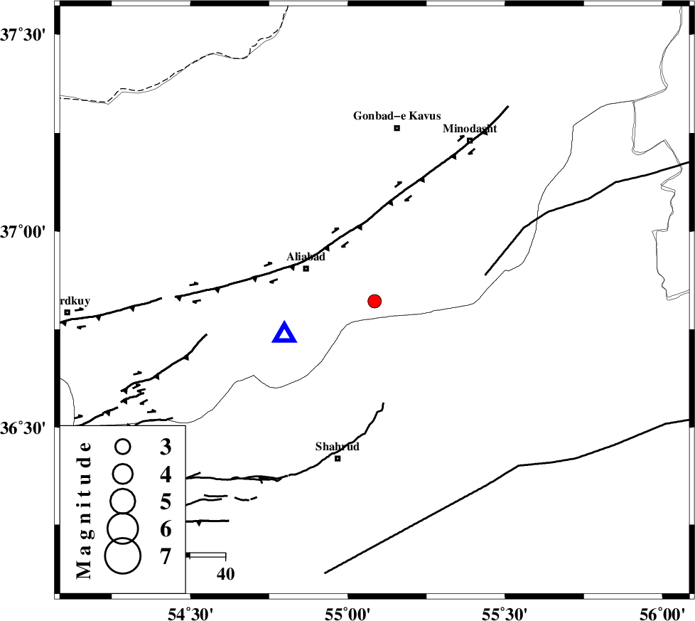
| Location | Lat:36.822 Lon: 55.085 |
| Region | Golestan Province, 22 km South of Ramian |
Nearest Cities |
|
| 21 km North of Qaleh-ye nokharqan, Semnan Province | |
| 21 km East of Ali Abad, Golestan Province | |
| 22 km South of Ramian, Golestan Province | |
| 23 km South of Khanbebin, Golestan Province | |
| 24 km South of Deland, Golestan Province | |
| Depth | 6 km |
| Agency | |
Faults within 150 km: |
|
| SHAVAR_F (Length: 87 km) , Distance to epicenter: 10 km | |
| KHAZAR_F (Length: 523 km) , Distance to epicenter: 23 km | |
| ROBATE_QARABIL_F (Length: 168 km) , Distance to epicenter: 32 km | |
| Number of Phases | 6 |
| RMS | 0.1 |
| Number of Stations | 5 |
| Error in Latitude | >1.9 km |
| Error in Longitude | 8.3 km |
| Error in Depth | 3.5 km |
Download waveform in seisan format
to download seisan software Click here
to access information about IIEES stations Click here
Amplitude | ||||||||
| UID | Agency | Station | Component | Amplitude | Period | Arrival Time | Proccessing Time | Signal Clip |
| 100384 | IIEES | SHRO | N | 213.7 | 0.25 | 2015-08-17 20:37:59 | 2015-08-18 09:42:00 | n |
| 100385 | IIEES | SHRO | E | 194.8 | 0.16 | 2015-08-17 20:38:00 | 2015-08-18 09:42:00 | n |
| 100386 | IIEES | BJRD | E | 52.6 | 0.3 | 2015-08-17 20:38:28 | 2015-08-18 09:42:00 | n |
Phase | ||||||||||||
| Agency | Station | Component | Phase Type | Phase Quality | First Motion | Observed Arrival Time | Time Residual | Loc. Flag | Input Weight | Distance | Azimuth | |
| IIEES | SHRO | Z | Pg | E | 2015-08-17 20:37:41 | -0.02 | y | 123 | 137 | |||
| IIEES | MRVT | Z | Pg | E | 2015-08-17 20:37:42 | -0.02 | y | 129 | 43 | |||
| IIEES | MRVT | N | Sg | E | 2015-08-17 20:37:58 | 0.04 | y | 129 | 43 | |||
| IIEES | BJRD | Z | Pn | E | 2015-08-17 20:37:56 | -0.06 | y | 228 | 64 | |||
| IIEES | TABS | Z | Pn | E | 2015-08-17 20:38:18 | 0.14 | y | 398 | 152 | |||
| IIEES | BSRN | Z | Pn | E | 2015-08-17 20:38:49 | -0.11 | y | 654 | 144 | |||