
Magnitude |
:3.5 |
| Date & Time (UTC) | 2015-08-14 22:26:17.0 |
| Date & Time (Local) | 1394/5/24 02:56:17.0 |
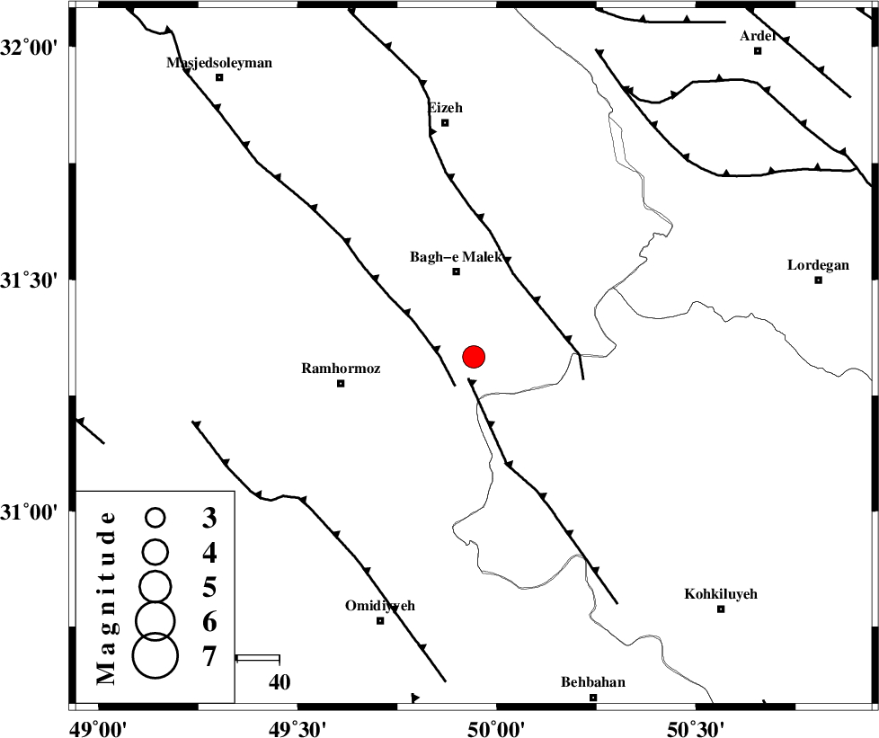
| Location | Lat:31.333 Lon: 49.942 |
| Region | Khoozestan Province, 21 km South of Bagh Malek |
Nearest Cities |
|
| 6 km North of Dalan, Khoozestan Province | |
| 13 km West of Seidun, Khoozestan Province | |
| 21 km South of Bagh Malek, Khoozestan Province | |
| 24 km South of Abolabbas, Khoozestan Province | |
| 25 km South East of Midavood-e sofla, Khoozestan Province | |
| Depth | 15 km |
| Agency | |
Faults within 150 km: |
|
| MFF4 (Length: 62 km) , Distance to epicenter: 5 km | |
| DEZFUL_EMBAYMENT (Length: 228 km) , Distance to epicenter: 8 km | |
| MFF2 (Length: 205 km) , Distance to epicenter: 22 km | |
| Number of Phases | 5 |
| RMS | 0.2 |
| Number of Stations | 6 |
| Error in Latitude | >2.4 km |
| Error in Longitude | 3.5 km |
| Error in Depth | 0 km |
Download waveform in seisan format
to download seisan software Click here
to access information about IIEES stations Click here
Amplitude | ||||||||
| UID | Agency | Station | Component | Amplitude | Period | Arrival Time | Proccessing Time | Signal Clip |
| 100347 | IIEES | SNGE | N | 46.7 | 0.31 | 2015-08-14 22:28:13 | 2015-08-15 06:19:00 | n |
Phase | ||||||||||||
| Agency | Station | Component | Phase Type | Phase Quality | First Motion | Observed Arrival Time | Time Residual | Loc. Flag | Input Weight | Distance | Azimuth | |
| IIEES | KHMZ | Z | Pn | E | 2015-08-14 22:26:57 | -0.16 | y | 267 | 0 | |||
| IIEES | AHRM | Z | Pn | E | 2015-08-14 22:27:02 | 0.04 | y | 303 | 154 | |||
| IIEES | NASN | Z | Pn | E | 2015-08-14 22:27:04 | 0.16 | y | 316 | 58 | |||
| IIEES | GHVR | Z | Pn | E | 2015-08-14 22:27:10 | 0.21 | y | 370 | 19 | |||
| IIEES | YZKH | Z | Pn | E | 2015-08-14 22:27:21 | -0.28 | y | 455 | 74 | |||