
Magnitude |
:2.5 |
| Date & Time (UTC) | 2015-08-13 08:09:06.5 |
| Date & Time (Local) | 1394/5/22 12:39:06.5 |
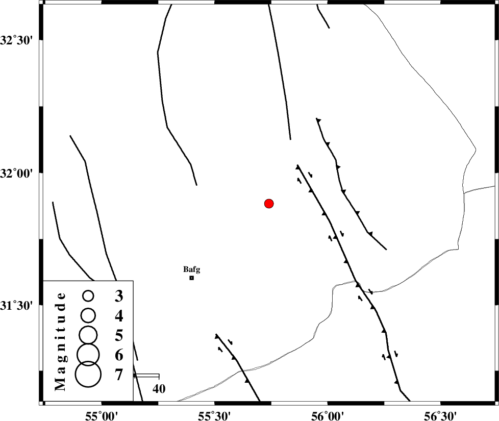
| Location | Lat:31.884 Lon: 55.74 |
| Region | Yazd Province, 45 km North-East of Bafq |
Nearest Cities |
|
| 17 km North of Kushk, Yazd Province | |
| 27 km North West of Behabad, Yazd Province | |
| 36 km North West of Benestan, Yazd Province | |
| 41 km North East of Mobarake, Yazd Province | |
| 45 km North East of Bafq, Yazd Province | |
| Depth | 14 km |
| Agency | |
Faults within 150 km: |
|
| KUHBANAN_F (Length: 189 km) , Distance to epicenter: 20 km | |
| SARBALA_F (Length: 92 km) , Distance to epicenter: 28 km | |
| JAFARABAD_F (Length: 60 km) , Distance to epicenter: 31 km | |
| Number of Phases | 4 |
| RMS | 0.1 |
| Number of Stations | 4 |
| Error in Latitude | >2.5 km |
| Error in Longitude | 3.3 km |
| Error in Depth | 8.1 km |
Download waveform in seisan format
to download seisan software Click here
to access information about IIEES stations Click here
Amplitude | ||||||||
| UID | Agency | Station | Component | Amplitude | Period | Arrival Time | Proccessing Time | Signal Clip |
| 100338 | IIEES | YZKH | N | 102.9 | 0.27 | 2015-08-13 08:09:42 | 2015-08-15 06:19:00 | n |
Phase | ||||||||||||
| Agency | Station | Component | Phase Type | Phase Quality | First Motion | Observed Arrival Time | Time Residual | Loc. Flag | Input Weight | Distance | Azimuth | |
| IIEES | KRBR | Z | Pn | E | 2015-08-13 08:09:43 | 0.14 | y | 232 | 155 | |||
| IIEES | KRBR | N | Sg | E | 2015-08-13 08:10:12 | -0.08 | y | 232 | 155 | |||
| IIEES | TABS | Z | Pn | E | 2015-08-13 08:09:43 | -0.03 | y | 235 | 33 | |||
| IIEES | NASN | Z | P | E | 2015-08-13 08:09:51 | -0.03 | y | 294 | 291 | |||