
Magnitude |
:2.6 |
| Date & Time (UTC) | 2015-08-09 13:45:12.8 |
| Date & Time (Local) | 1394/5/18 18:15:12.8 |
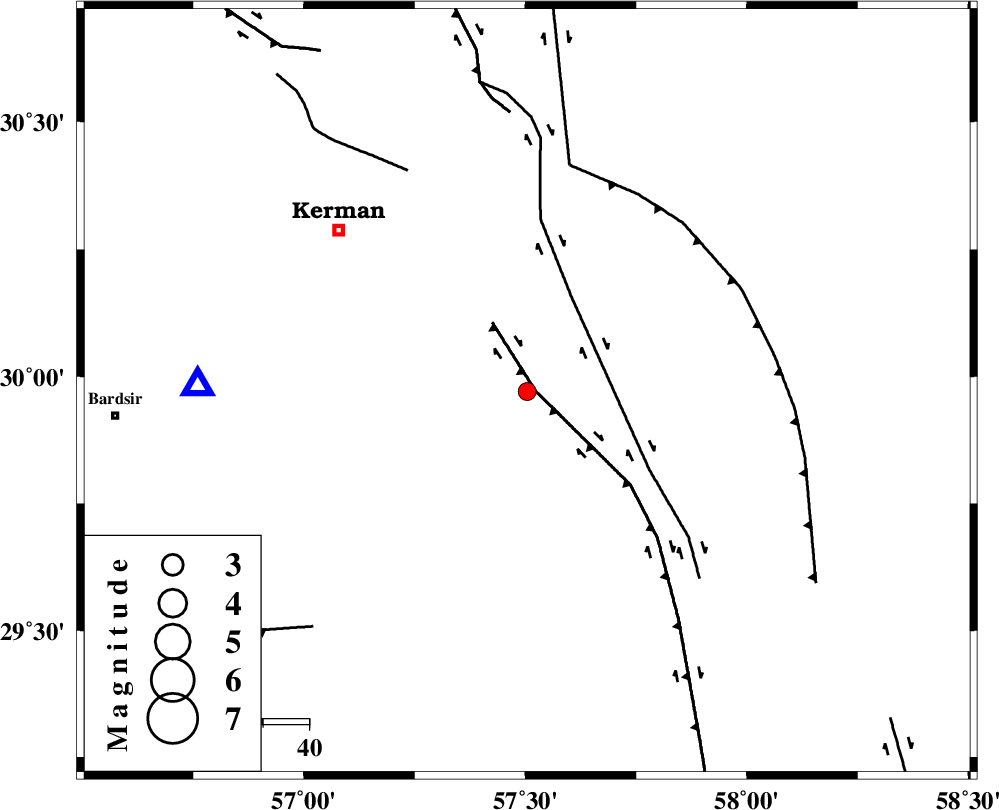
| Location | Lat:29.971 Lon: 57.504 |
| Region | Kerman Province, 54 km South-East of Kerman |
Nearest Cities |
|
| 19 km South West of Jushan, Kerman Province | |
| 22 km East of Mahan, Kerman Province | |
| 24 km East of Langar, Kerman Province | |
| 26 km South of Sirch, Kerman Province | |
| 29 km South East of Mohiabad, Kerman Province | |
| Depth | 30 km |
| Agency | |
Faults within 150 km: |
|
| GOWK_F (Length: 152 km) , Distance to epicenter: 2 km | |
| GOLBAF_SIRCH_F (Length: 114 km) , Distance to epicenter: 23 km | |
| SHAHDAD_F (Length: 108 km) , Distance to epicenter: 49 km | |
| Number of Phases | 7 |
| RMS | 0.2 |
| Number of Stations | 6 |
| Error in Latitude | >2.5 km |
| Error in Longitude | 3.2 km |
| Error in Depth | 4.6 km |
Download waveform in seisan format
to download seisan software Click here
to access information about IIEES stations Click here
Amplitude | ||||||||
| UID | Agency | Station | Component | Amplitude | Period | Arrival Time | Proccessing Time | Signal Clip |
| 100285 | IIEES | BNDS | N | 21 | 0.32 | 2015-08-09 13:46:15 | 2015-08-10 06:31:00 | n |
Phase | ||||||||||||
| Agency | Station | Component | Phase Type | Phase Quality | First Motion | Observed Arrival Time | Time Residual | Loc. Flag | Input Weight | Distance | Azimuth | |
| IIEES | KRBR | Z | Pg | E | 2015-08-09 13:45:25 | -0.07 | y | 71.7 | 271 | |||
| IIEES | KRBR | E | Sg | E | 2015-08-09 13:45:35 | 0.06 | y | 71.7 | 271 | |||
| IIEES | BSRN | Z | Pn | E | 2015-08-09 13:45:52 | 0.04 | y | 270 | 35 | |||
| IIEES | BNDS | Z | Pn | E | 2015-08-09 13:45:57 | -0.09 | y | 313 | 205 | |||
| IIEES | ZHSF | Z | Pn | E | 2015-08-09 13:45:58 | 0.11 | y | 319 | 96 | |||
| IIEES | YZKH | Z | Pn | E | 2015-08-09 13:46:07 | 0.25 | y | 386 | 315 | |||
| IIEES | TABS | Z | Pn | E | 2015-08-09 13:46:09 | -0.31 | y | 409 | 355 | |||