
Magnitude |
:3 |
| Date & Time (UTC) | 2015-07-21 21:44:53.6 |
| Date & Time (Local) | 1394/4/31 02:14:53.6 |
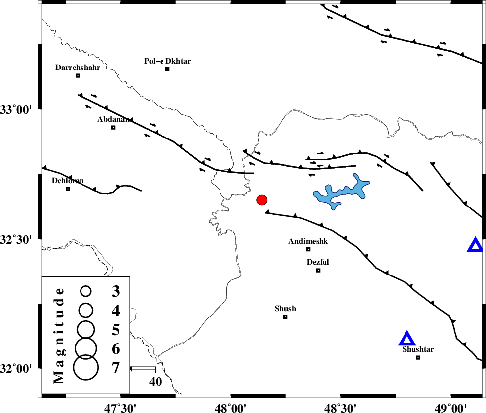
| Location | Lat:32.651 Lon: 48.142 |
| Region | Khoozestan Province, 29 km North-West of Andimeshk |
Nearest Cities |
|
| 10 km West of Hoseinieh, Khoozestan Province | |
| 15 km South of Bidruyeh, Khoozestan Province | |
| 22 km South West of Sorkhakan, Khoozestan Province | |
| 29 km North West of Andimeshk, Khoozestan Province | |
| 39 km North West of Dezful, Khoozestan Province | |
| Depth | 14 km |
| Agency | |
Faults within 150 km: |
|
| DEZFUL_EMBAYMENT (Length: 228 km) , Distance to epicenter: 6 km | |
| BALARUD_F_Z1 (Length: 87 km) , Distance to epicenter: 12 km | |
| BALARUD_F_Z3 (Length: 53 km) , Distance to epicenter: 16 km | |
| Number of Phases | 5 |
| RMS | 0 |
| Number of Stations | 4 |
| Error in Latitude | >1.5 km |
| Error in Longitude | 3.8 km |
| Error in Depth | 4.6 km |
Download waveform in seisan format
to download seisan software Click here
to access information about IIEES stations Click here
Amplitude | ||||||||
| UID | Agency | Station | Component | Amplitude | Period | Arrival Time | Proccessing Time | Signal Clip |
| 100152 | IIEES | ASAO | N | 68.7 | 0.42 | 2015-07-21 21:46:16 | 2015-07-22 08:16:00 | n |
| 100153 | IIEES | ASAO | E | 70.3 | 0.68 | 2015-07-21 21:46:17 | 2015-07-22 08:16:00 | n |
Phase | ||||||||||||
| Agency | Station | Component | Phase Type | Phase Quality | First Motion | Observed Arrival Time | Time Residual | Loc. Flag | Input Weight | Distance | Azimuth | |
| IIEES | SHGR | Z | Pg | E | 2015-07-21 21:45:08 | -0.02 | y | 86.5 | 134 | |||
| IIEES | ASAO | Z | Pn | E | 2015-07-21 21:45:35 | -0.05 | y | 274 | 39 | |||
| IIEES | ASAO | E | Sg | E | 2015-07-21 21:46:10 | -0.01 | y | 274 | 39 | |||
| IIEES | SNGE | Z | Pn | E | 2015-07-21 21:45:36 | 0 | y | 281 | 345 | |||
| IIEES | GHVR | Z | Pn | E | 2015-07-21 21:45:45 | 0.09 | y | 352 | 54 | |||