
Magnitude |
:3 |
| Date & Time (UTC) | 2015-07-21 20:55:06.6 |
| Date & Time (Local) | 1394/4/31 01:25:06.6 |
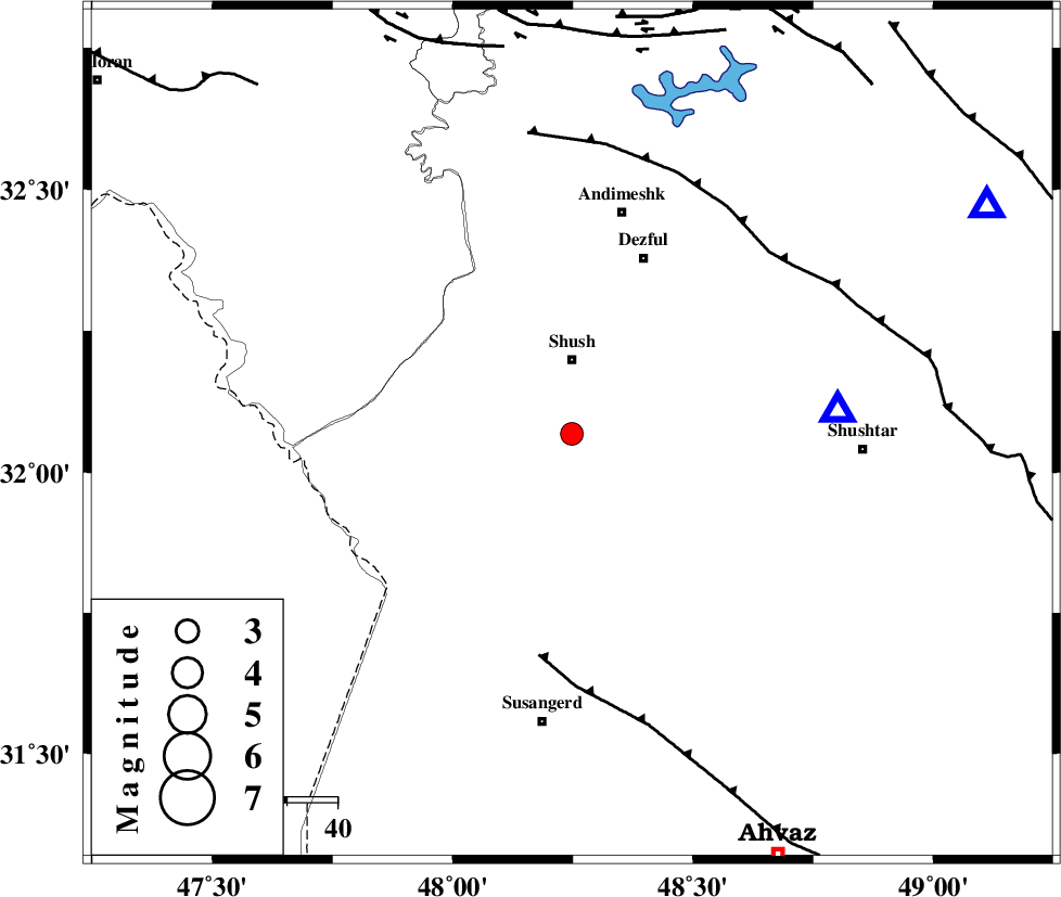
| Location | Lat:32.068 Lon: 48.248 |
| Region | Khoozestan Province, 15 km South of Shush |
Nearest Cities |
|
| 13 km South of Amaleh teimur, Khoozestan Province | |
| 15 km South of Shush, Khoozestan Province | |
| 30 km North West of Abdolkhan-eali, Khoozestan Province | |
| 31 km South West of Shamsabad, Khoozestan Province | |
| 37 km South West of Dezful, Khoozestan Province | |
| Depth | 14 km |
| Agency | |
Faults within 150 km: |
|
| AHVAZ_F (Length: 99 km) , Distance to epicenter: 44 km | |
| DEZFUL_EMBAYMENT (Length: 228 km) , Distance to epicenter: 53 km | |
| BALARUD_F_Z1 (Length: 87 km) , Distance to epicenter: 77 km | |
| Number of Phases | 5 |
| RMS | 0.2 |
| Number of Stations | 4 |
| Error in Latitude | >3.2 km |
| Error in Longitude | 7.1 km |
| Error in Depth | 8.2 km |
Download waveform in seisan format
to download seisan software Click here
to access information about IIEES stations Click here
Amplitude | ||||||||
| UID | Agency | Station | Component | Amplitude | Period | Arrival Time | Proccessing Time | Signal Clip |
| 100151 | IIEES | ASAO | N | 46.2 | 0.26 | 2015-07-21 20:56:42 | 2015-07-22 08:16:00 | n |
Phase | ||||||||||||
| Agency | Station | Component | Phase Type | Phase Quality | First Motion | Observed Arrival Time | Time Residual | Loc. Flag | Input Weight | Distance | Azimuth | |
| IIEES | SHGR | Z | Pg | E | 2015-07-21 20:55:15 | -0.1 | y | 52.4 | 85 | |||
| IIEES | ASAO | Z | Pn | E | 2015-07-21 20:55:54 | 0.28 | y | 321 | 31 | |||
| IIEES | ASAO | N | Sg | E | 2015-07-21 20:56:36 | -0.06 | y | 321 | 31 | |||
| IIEES | SNGE | Z | Pn | E | 2015-07-21 20:55:57 | -0.16 | y | 346 | 346 | |||
| IIEES | GHVR | Z | Pn | E | 2015-07-21 20:56:02 | 0.04 | y | 387 | 45 | |||