
Magnitude |
:3.1 |
| Date & Time (UTC) | 2015-07-19 00:55:03.4 |
| Date & Time (Local) | 1394/4/28 05:25:03.4 |
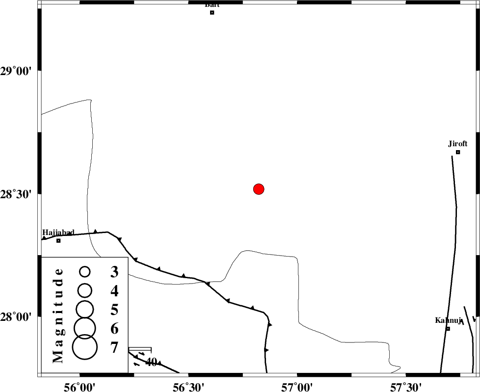
| Location | Lat:28.518 Lon: 56.823 |
| Region | Kerman Province, 82 km South-East of Baft |
Nearest Cities |
|
| 20 km North of Sarkhan, Kerman Province | |
| 33 km South West of Dolatabad, Kerman Province | |
| 43 km North East of Shahmaran, Kerman Province | |
| 46 km North East of Arzuieeh, Kerman Province | |
| 53 km South East of Kashkueyeh, Kerman Province | |
| Depth | 15 km |
| Agency | |
Faults within 150 km: |
|
| MAIN_ZAGROS_R_F (Length: 1106 km) , Distance to epicenter: 49 km | |
| SABZEVARAN_F (Length: 190 km) , Distance to epicenter: 88 km | |
| HZF2 (Length: 437 km) , Distance to epicenter: 91 km | |
| Number of Phases | 5 |
| RMS | 0.3 |
| Number of Stations | 4 |
| Error in Latitude | >3 km |
| Error in Longitude | 7.6 km |
| Error in Depth | 9.9 km |
Download waveform in seisan format
to download seisan software Click here
to access information about IIEES stations Click here
Amplitude | ||||||||
| UID | Agency | Station | Component | Amplitude | Period | Arrival Time | Proccessing Time | Signal Clip |
| 100129 | IIEES | BNDS | E | 423.8 | 0.21 | 2015-07-19 00:55:45 | 2015-07-21 11:03:00 | n |
| 100130 | IIEES | BNDS | N | 324.3 | 0.21 | 2015-07-19 00:55:46 | 2015-07-21 11:03:00 | n |
Phase | ||||||||||||
| Agency | Station | Component | Phase Type | Phase Quality | First Motion | Observed Arrival Time | Time Residual | Loc. Flag | Input Weight | Distance | Azimuth | |
| IIEES | BNDS | Z | Pg | E | 2015-07-19 00:55:26 | -0.16 | y | 140 | 208 | |||
| IIEES | BNDS | N | Sg | E | 2015-07-19 00:55:43 | 0.05 | y | 140 | 208 | |||
| IIEES | KRBR | Z | Pg | E | 2015-07-19 00:55:30 | -0.39 | y | 162 | 358 | |||
| IIEES | ZHSF | Z | Pn | E | 2015-07-19 00:56:01 | 0.13 | y | 403 | 72 | |||
| IIEES | YZKH | Z | Pn | E | 2015-07-19 00:56:11 | 0.58 | y | 480 | 334 | |||