
| Prel. Rep. | Date | Time(UTC) | Time(Local) | Lat. | Lon. | Depth | Mag. | Region | Waveform |
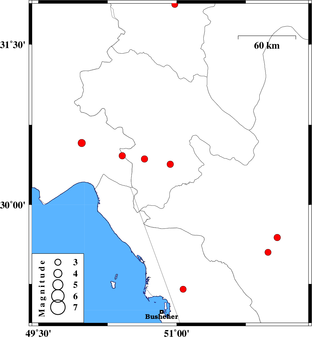
| 2013/03/29 | 12:13:55.0 | 16:43:55.0 | 30.38 | 50.93 | 15 | ML:3.3 | Kohkiluieh va boyerahmad Province, 14 km East of Dogonbadan | ||
| 2013/03/28 | 15:54:28.0 | 20:24:28.0 | 30.46 | 50.41 | 15 | ML:3.3 | Khoozestan Province, 22 km South-East of Behbahan | ||
| 2013/03/23 | 11:02:39.8 | 15:32:39.8 | 29.55 | 51.99 | 17 | ML:3.1 | Fars Province, 33 km East of Kazerun | ||
| 2013/03/21 | 17:45:12.7 | 21:15:12.7 | 30.58 | 49.97 | 27 | ML:3.6 | Khoozestan Province, 26 km West of Behbahan | ||
| 2013/03/16 | 19:33:38.1 | 23:03:38.1 | 29.2 | 51.07 | 17 | ML:3.1 | Bushehr Province, 15 km West of Borazjan | ||
| 2013/03/11 | 22:57:19.3 | 02:27:19.3 | 30.43 | 50.65 | 42 | ML:3.2 | Kohkiluieh va boyerahmad Province, 16 km West of Dogonbadan | ||
| 2013/03/02 | 21:06:28.0 | 00:36:28.0 | 31.87 | 50.98 | 46 | ML:3.1 | Chaharmahal Bakhtiari Province, 31 km West of Borujen | ||
| 2013/02/28 | 14:56:49.1 | 18:26:49.1 | 29.69 | 52.09 | 40 | ML:3.2 | Fars Province, 43 km East of Kazerun |