| Prel. Rep. | Date | Time(UTC) | Time(Local) | Lat. | Lon. | Depth | Mag. | Region | Waveform |
|
|
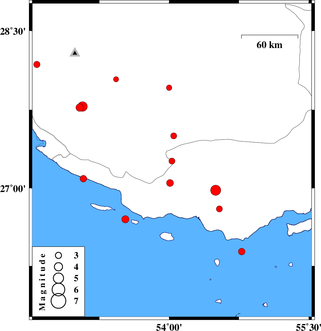
2010/10/06
|
19:27:44.1
|
22:57:44.1
| 27.26 | 54.03 | 26 |
ML:2.9
|
Hormozgan Province, 34 km West of Bastak | |
|
|
2010/10/02
|
21:12:19.8
|
00:42:19.8
| 28.18 | 52.58 | 31 |
ML:3.1
|
Fars Province, 46 km North-East of Jam | |
|
|
2010/10/01
|
08:17:02.0
|
11:47:02.0
| 27.77 | 53.04 | 14 |
ML:3.7
|
Fars Province, 28 km North-East of Mehr | |
|
|
2010/09/27
|
05:53:42.5
|
09:23:42.5
| 26.7 | 53.53 | 46 |
ML:3.5
|
Persian Gulf, 79 km South-East of Lamerd | |
|
|
2010/09/25
|
01:06:05.1
|
04:36:05.1
| 27.05 | 54.01 | 14 |
ML:3.4
|
Hormozgan Province, 38 km South-West of Bastak | |
|
|
2010/09/21
|
06:13:40.5
|
10:43:40.5
| 27.5 | 54.05 | 14 |
ML:3
|
Fars Province, 35 km South-West of Lar | |
|
|
2010/09/18
|
23:07:29.4
|
03:37:29.4
| 27.96 | 54 | 15 |
ML:2.7
|
Fars Province, 46 km North-West of Lar | |
|
|
2010/09/12
|
06:00:26.0
|
10:30:26.0
| 28.04 | 53.43 | 11 |
ML:2.6
|
Fars Province, 53 km South-West of Jahrom | |
|
|
2010/09/11
|
16:32:10.6
|
21:02:10.6
| 26.39 | 54.78 | 15 |
ML:3.3
|
Persian Gulf, 17 km South of Bandar-e lengeh | |
|
|
2010/09/08
|
12:33:29.5
|
17:03:29.5
| 27.78 | 53.07 | 14 |
ML:4.7
|
Fars Province, 31 km North-East of Mehr | |
|
|
2010/09/08
|
02:30:06.5
|
07:00:06.5
| 26.8 | 54.54 | 44 |
ML:3
|
Hormozgan Province, 48 km South-East of Bastak | |
|
|
2010/09/07
|
02:53:45.7
|
07:23:45.7
| 27.09 | 53.08 | 17 |
ML:3.2
|
Persian Gulf, 28 km South of Lamerd | |
|
|
2010/09/07
|
02:11:04.3
|
06:41:04.3
| 26.98 | 54.5 | 31 |
ML:4.9
|
Hormozgan Province, 27 km South-East of Bastak | |
