
| Prel. Rep. | Date | Time(UTC) | Time(Local) | Lat. | Lon. | Depth | Mag. | Region | Waveform |
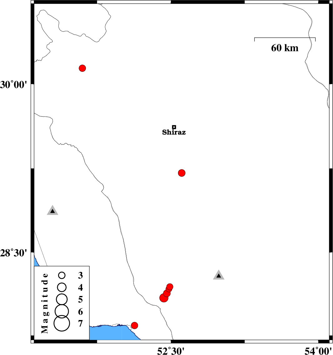
| 2010/07/09 | 22:40:41.6 | 03:10:41.6 | 29.21 | 52.61 | 18 | ML:3.2 | Fars Province, 42 km North of Firuz Abad | ||
| 2010/07/09 | 18:16:25.9 | 22:46:25.9 | 30.14 | 51.6 | 14 | ML:3.1 | Fars Province, 8 km Nurabad | ||
| 2010/07/05 | 02:20:46.6 | 06:50:46.6 | 28.19 | 52.49 | 22 | ML:2.9 | Fars Province, 43 km North-East of Jam | ||
| 2010/07/04 | 20:10:35.7 | 00:40:35.7 | 28.17 | 52.48 | 24 | ML:2.8 | Fars Province, 40 km North-East of Jam | ||
| 2010/07/04 | 19:58:23.7 | 00:28:23.7 | 28.13 | 52.46 | 30 | ML:3.3 | Fars Province, 36 km North-East of Jam | ||
| 2010/07/03 | 08:50:40.3 | 13:20:40.3 | 27.84 | 52.13 | 14 | ML:3.1 | Bushehr Province, 7 km Bandar-e kangan | ||
| 2010/07/02 | 22:34:45.8 | 03:04:45.8 | 28.09 | 52.43 | 14 | ML:3.9 | Fars Province, 31 km North-East of Jam |