
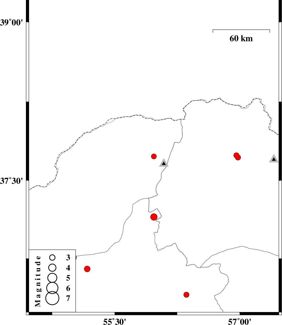
| Prel. Rep. | Date | Time(UTC) | Time(Local) | Lat. | Lon. | Depth | Mag. | Region | Waveform |
| 2010/05/20 | 11:09:00.9 | 15:39:00.9 | 37.73 | 55.97 | 12 | ML:2.8 | Golestan Province, 57 km North-East of Kalaleh | ||
| 2010/05/20 | 06:48:22.5 | 11:18:22.5 | 37.74 | 56.96 | 14 | ML:2.9 | Khorasan(north) Province, 21 km North of Ashkhaneh | ||
| 2010/05/19 | 09:43:52.0 | 14:13:52.0 | 37.72 | 56.98 | 14 | ML:2.9 | Khorasan(north) Province, 19 km North of Ashkhaneh | ||
| 2010/05/12 | 21:11:29.3 | 01:41:29.3 | 37.15 | 55.97 | 6 | ML:3.6 | Semnan Province, 44 km North-West of Jajarm | ||
| 2010/05/03 | 17:49:02.0 | 22:19:02.0 | 36.4 | 56.36 | 23 | ML:2.9 | Semnan Province, 61 km South of Jajarm | ||
| 2010/05/03 | 02:30:19.4 | 07:00:19.4 | 36.65 | 55.17 | 15 | ML:3.2 | Semnan Province, 41 km South of Ramian | ||
| 2010/04/30 | 22:01:23.1 | 02:31:23.1 | 36.76 | 55.01 | 14 | ML:2.8 | Semnan Province, 20 km South-East of Ali Abad | ||
| 2010/04/30 | 18:41:38.3 | 23:11:38.3 | 36.75 | 55 | 14 | ML:3.2 | Semnan Province, 21 km South-East of Ali Abad |