
| Prel. Rep. | Date | Time(UTC) | Time(Local) | Lat. | Lon. | Depth | Mag. | Region | Waveform |
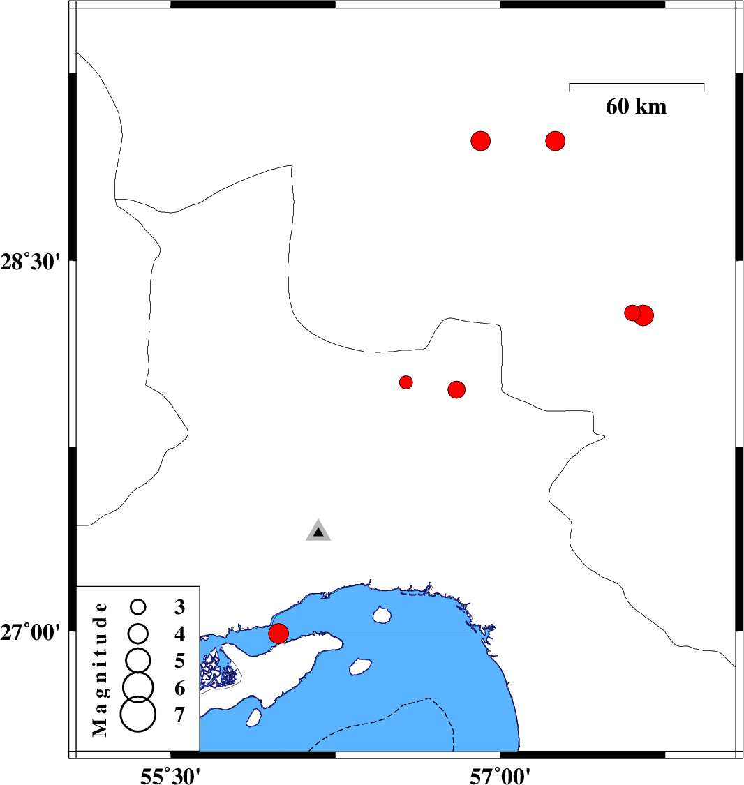
| 2007/01/16 | 16:41:14.4 | 20:11:14.4 | 28.01 | 56.57 | 14 | ML:2.7 | 73 km South-East of Hajiabad, Hormozgan Province | ||
| 2006/12/31 | 23:26:51.1 | 02:56:51.1 | 28.29 | 57.6 | 15 | ML:3.3 | 38 km North of Kahnuj, Kerman Province | ||
| 2006/12/28 | 19:48:41.3 | 23:18:41.3 | 28.28 | 57.65 | 14 | ML:4.3 | 37 km North of Kahnuj, Kerman Province | ||
| 2006/12/28 | 03:32:46.9 | 07:02:46.9 | 28.98 | 57.25 | 26 | ML:3.9 | 58 km North-West of Jiroft, Kerman Province | ||
| 2006/12/24 | 11:35:52.1 | 15:05:52.1 | 28.98 | 56.91 | 15 | ML:3.9 | 40 km South-East of Baft, Kerman Province | ||
| 2006/12/21 | 15:06:04.5 | 18:36:04.5 | 27.98 | 56.8 | 44 | ML:3.5 | 75 km North-West of Dehbarez, Hormozgan Province | ||
| 2006/12/18 | 19:43:37.3 | 23:13:37.3 | 26.99 | 55.99 | 15 | ML:4.1 | Persian Gulf, 27 km West of Qeshm |