
| Prel. Rep. | Date | Time(UTC) | Time(Local) | Lat. | Lon. | Depth | Mag. | Region | Waveform |
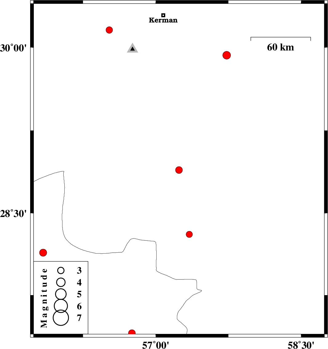
| 2026/01/31 | 21:55:51.3 | 01:25:51.3 | 28.892 | 57.24 | 15 | ML:3.3 | Kerman Province, 55 km North-West of Jiroft | ||
| 2026/01/24 | 17:58:49.7 | 21:28:49.7 | 27.401 | 56.754 | 12 | ML:3.2 | Hormozgan Province, 48 km -West of Dehbarez | ||
| 2026/01/24 | 09:59:20.1 | 13:29:20.1 | 28.307 | 57.347 | 12 | ML:3 | Kerman Province, 52 km North-West of Kahnuj | ||
| 2026/01/19 | 16:34:18.5 | 20:04:18.5 | 29.929 | 57.733 | 12 | ML:3.6 | Kerman Province, 75 km South-East of Kerman | ||
| 2026/01/17 | 14:07:43.6 | 17:37:43.6 | 30.156 | 56.521 | 12 | ML:3.1 | Kerman Province, 26 km North of Bardsir | ||
| 2026/01/05 | 20:05:19.7 | 23:35:19.7 | 28.139 | 55.838 | 12 | ML:3.4 | Hormozgan Province, 20 km South of Hajiabad | ||
| 2026/01/02 | 04:56:42.7 | 08:26:42.7 | 27.634 | 56.218 | 17 | ML:3.2 | Hormozgan Province, 50 km North of Bandar-e abbas |