| Prel. Rep. | Date | Time(UTC) | Time(Local) | Lat. | Lon. | Depth | Mag. | Region | Waveform |
|
|
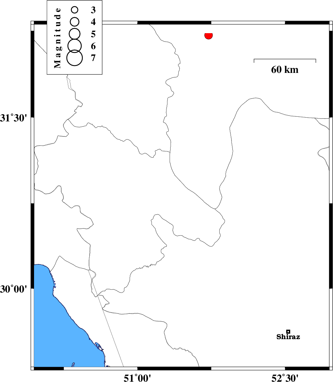
2026/01/09
|
23:45:47.4
|
03:15:47.4
| 30.806 | 51.449 | 12 |
ML:3.5
|
Kohkiluieh va boyerahmad Province, 7 km of Sisakht | |
|
|
2026/01/09
|
08:12:44.9
|
11:42:44.9
| 30.11 | 51.925 | 12 |
ML:3.5
|
Fars Province, 18 km South of Ardakan | |
|
|
2026/01/06
|
15:07:37.5
|
18:37:37.5
| 31.077 | 50.226 | 12 |
ML:4.4
|
Kohkiluieh va boyerahmad Province, 54 km North of Behbahan | |
|
|
2026/01/06
|
12:28:13.9
|
15:58:13.9
| 31.064 | 50.089 | 16 |
ML:3.4
|
Kohkiluieh va boyerahmad Province, 54 km North-West of Behbahan | |
|
|
2025/12/30
|
17:56:08.8
|
21:26:08.8
| 30.404 | 52.117 | 12 |
ML:3.9
|
Fars Province, 20 km North-East of Ardakan | |
|
|
2025/12/26
|
07:55:40.9
|
11:25:40.9
| 30.51 | 50.427 | 12 |
ML:3.3
|
Kohkiluieh va boyerahmad Province, 20 km -East of Behbahan | |
|
|
2025/12/24
|
21:24:21.5
|
00:54:21.5
| 30.479 | 50.48 | 12 |
ML:3.4
|
Kohkiluieh va boyerahmad Province, 26 km South-East of Behbahan | |
|
|
2025/12/24
|
10:08:52.3
|
13:38:52.3
| 29.654 | 51.592 | 12 |
ML:3.7
|
Fars Province, 7 km of Kazerun | |
|
|
2025/12/21
|
04:30:27.8
|
08:00:27.8
| 29.642 | 50.349 | 8 |
ML:3
|
Persian Gulf, 18 km -West of Bandar-e genaveh | |
|
|
2025/12/17
|
21:08:38.5
|
00:38:38.5
| 30.238 | 51.991 | 12 |
ML:3.4
|
Fars Province, 3 km of Ardakan | |
|
|
2025/12/10
|
12:58:12.2
|
16:28:12.2
| 29.689 | 51.237 | 12 |
ML:3.2
|
Bushehr Province, 48 km North of Borazjan | |
