
| Prel. Rep. | Date | Time(UTC) | Time(Local) | Lat. | Lon. | Depth | Mag. | Region | Waveform |
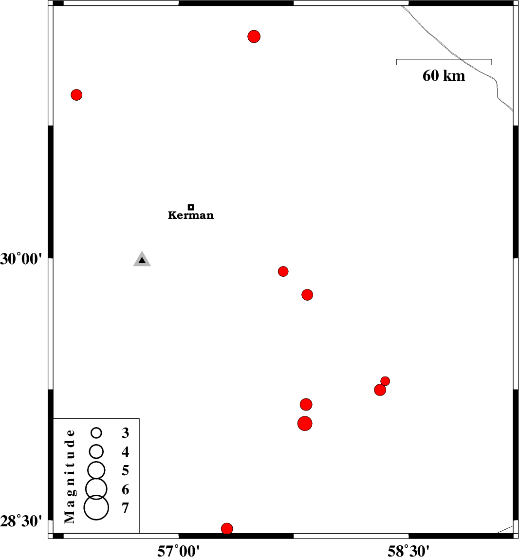
| 2025/10/18 | 20:06:19.2 | 23:36:19.2 | 29.923 | 57.681 | 12 | ML:3 | Kerman Province, 71 km South-East of Kerman | ||
| 2025/10/03 | 19:53:22.6 | 23:23:22.6 | 29.056 | 57.823 | 14 | ML:4.3 | Kerman Province, 44 km North of Jiroft | ||
| 2025/10/02 | 19:10:51.3 | 22:40:51.3 | 29.164 | 57.83 | 10 | ML:3.5 | Kerman Province, 52 km -West of Bam | ||
| 2025/09/28 | 19:29:49.1 | 22:59:49.1 | 31.25 | 57.49 | 17 | ML:3.6 | Kerman Province, 64 km -East of Ravar | ||
| 2025/09/23 | 19:08:53.9 | 22:38:53.9 | 29.298 | 58.346 | 12 | ML:2.7 | Kerman Province, 21 km North of Bam | ||
| 2025/09/23 | 09:20:24.2 | 12:50:24.2 | 29.248 | 58.313 | 10 | ML:3.4 | Kerman Province, 16 km North of Bam | ||
| 2025/09/23 | 02:57:42.1 | 06:27:42.1 | 28.45 | 57.315 | 12 | ML:3.4 | Kerman Province, 48 km South-West of Jiroft | ||
| 2025/09/22 | 07:56:58.3 | 11:26:58.3 | 29.79 | 57.838 | 12 | ML:3.3 | Kerman Province, 91 km North-West of Bam | ||
| 2025/09/19 | 12:36:38.7 | 16:06:38.7 | 30.922 | 56.333 | 12 | ML:3.3 | Kerman Province, 26 km North-West of Zarand |