| Prel. Rep. | Date | Time(UTC) | Time(Local) | Lat. | Lon. | Depth | Mag. | Region | Waveform |
|
|
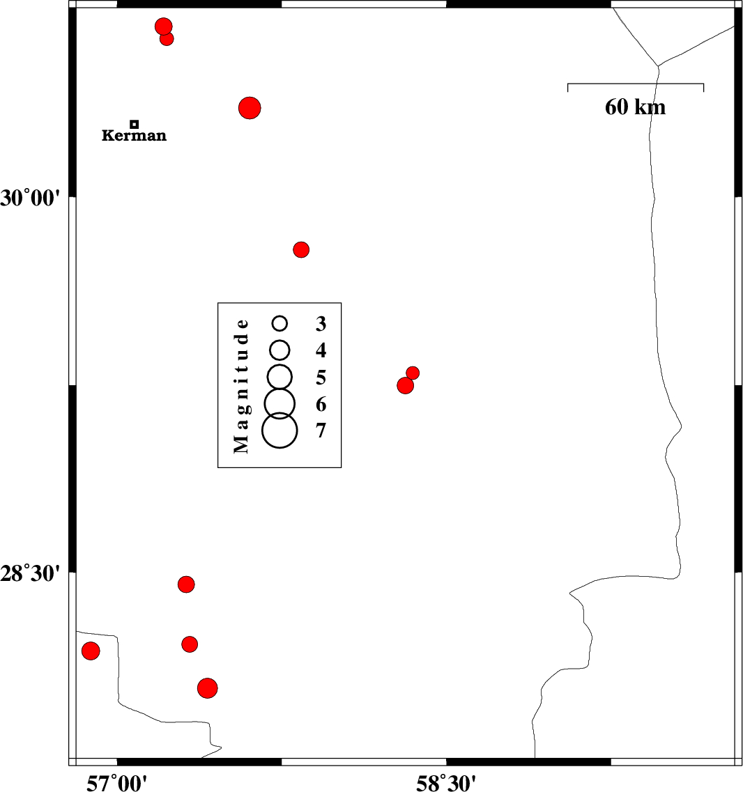
2025/09/23
|
19:08:53.9
|
22:38:53.9
| 29.298 | 58.346 | 12 |
ML:2.7
|
Kerman Province, 21 km North of Bam | |
|
|
2025/09/23
|
09:20:24.2
|
12:50:24.2
| 29.248 | 58.313 | 10 |
ML:3.4
|
Kerman Province, 16 km North of Bam | |
|
|
2025/09/23
|
02:57:42.1
|
06:27:42.1
| 28.45 | 57.315 | 12 |
ML:3.4
|
Kerman Province, 48 km South-West of Jiroft | |
|
|
2025/09/22
|
07:56:58.3
|
11:26:58.3
| 29.79 | 57.838 | 12 |
ML:3.3
|
Kerman Province, 91 km North-West of Bam | |
|
|
2025/09/21
|
10:42:53.2
|
14:12:53.2
| 28.182 | 56.88 | 12 |
ML:3.6
|
Hormozgan Province, 84 km North-West of Kahnuj | |
|
|
2025/09/15
|
09:07:24.1
|
12:37:24.1
| 30.673 | 57.212 | 12 |
ML:3.5
|
Kerman Province, 45 km North-East of Kerman | |
|
|
2025/09/12
|
06:51:42.1
|
10:21:42.1
| 28.209 | 57.33 | 12 |
ML:3.2
|
Kerman Province, 46 km North-West of Kahnuj | |
|
|
2025/09/10
|
16:21:22.8
|
19:51:22.8
| 28.031 | 57.411 | 12 |
ML:4.1
|
Kerman Province, 29 km -West of Kahnuj | |
|
|
2025/08/31
|
22:04:45.3
|
01:34:45.3
| 30.626 | 57.225 | 12 |
ML:2.8
|
Kerman Province, 40 km North-East of Kerman | |
|
|
2025/08/31
|
19:56:44.1
|
23:26:44.1
| 30.352 | 57.603 | 12 |
ML:4.5
|
Kerman Province, 51 km -East of Kerman | |
