| Prel. Rep. | Date | Time(UTC) | Time(Local) | Lat. | Lon. | Depth | Mag. | Region | Waveform |
|
|
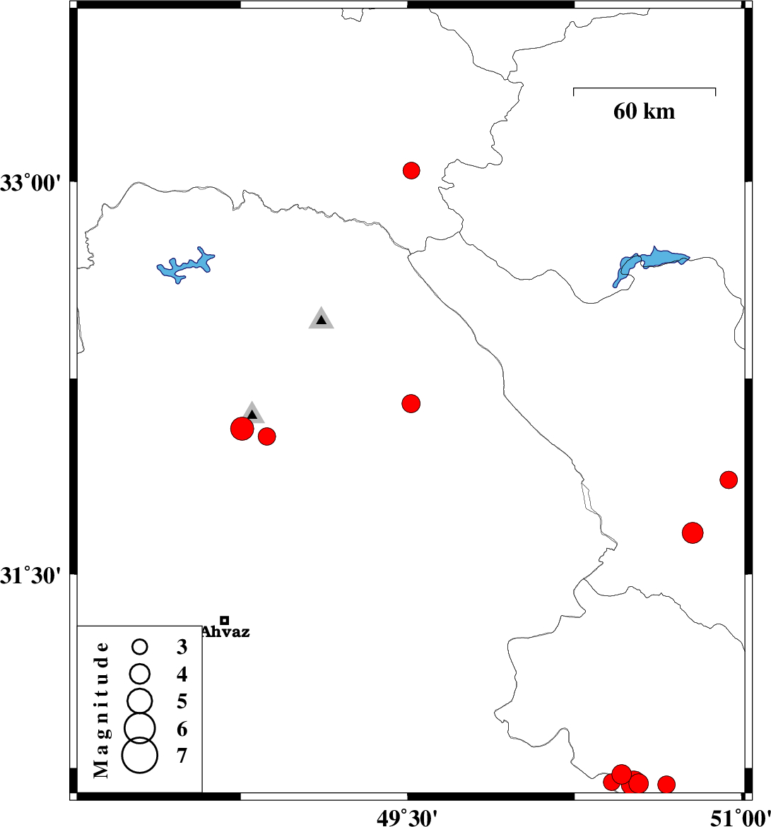
2025/06/06
|
17:01:36.5
|
20:31:36.5
| 32.154 | 49.515 | 12 |
ML:3.7
|
Khoozestan Province, 32 km North-East of Masjed Soleyman | |
|
|
2025/06/06
|
00:48:13.3
|
04:18:13.3
| 31.862 | 50.942 | 9 |
ML:3.5
|
Chaharmahal Bakhtiari Province, 31 km South-East of Ardel | |
|
|
2025/06/02
|
03:48:27.3
|
07:18:27.3
| 31.659 | 50.781 | 12 |
ML:4.3
|
Chaharmahal Bakhtiari Province, 18 km North of Lordegan | |
|
|
2025/05/30
|
21:05:44.4
|
00:35:44.4
| 30.726 | 50.462 | 12 |
ML:3.9
|
Kohkiluieh va boyerahmad Province, 12 km -West of Dehdasht | |
|
|
2025/05/29
|
13:22:16.5
|
16:52:16.5
| 30.689 | 50.538 | 12 |
ML:3.9
|
Kohkiluieh va boyerahmad Province, 11 km of Dehdasht | |
|
|
2025/05/27
|
21:39:08.4
|
01:09:08.4
| 30.695 | 50.417 | 12 |
ML:3.4
|
Kohkiluieh va boyerahmad Province, 17 km -West of Dehdasht | |
|
|
2025/05/27
|
02:18:45.7
|
05:48:45.7
| 30.686 | 50.663 | 12 |
ML:3.5
|
Kohkiluieh va boyerahmad Province, 15 km South of Dehdasht | |
|
|
2025/05/27
|
00:39:48.6
|
04:09:48.6
| 30.689 | 50.515 | 12 |
ML:5.1
|
Kohkiluieh va boyerahmad Province, 12 km of Dehdasht | |
|
|
2025/05/24
|
09:10:57.1
|
12:40:57.1
| 32.059 | 48.757 | 12 |
ML:4.6
|
Khoozestan Province, 9 km of Shushtar | |
|
|
2025/05/24
|
00:06:28.9
|
03:36:28.9
| 32.029 | 48.868 | 12 |
ML:3.5
|
Khoozestan Province, 2 km of Shushtar | |
|
|
2025/05/17
|
23:28:35.2
|
02:58:35.2
| 33.041 | 49.517 | 12 |
ML:3.4
|
Lorestan Province, 46 km South of Azna | |
