
| Prel. Rep. | Date | Time(UTC) | Time(Local) | Lat. | Lon. | Depth | Mag. | Region | Waveform |
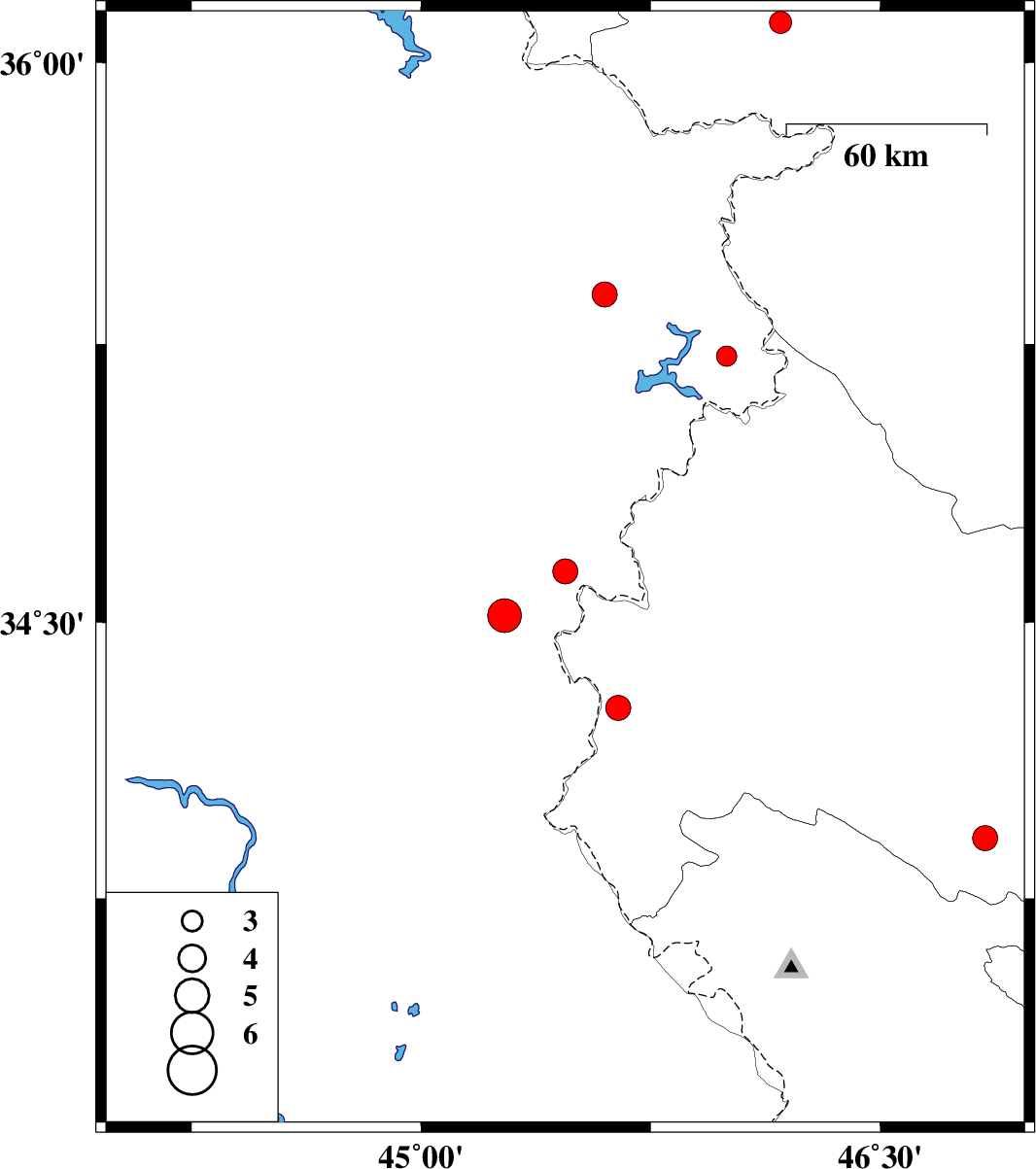
| 2025/03/03 | 21:56:43.4 | 01:26:43.4 | 34.638 | 45.471 | 12 | ML:3.7 | Iraq, 17 km North-West of Qasr-E-Shirin | ||
| 2025/03/03 | 20:53:23.3 | 00:23:23.3 | 34.519 | 45.273 | 23 | ML:4.9 | Iraq, 28 km -West of Qasr-E-Shirin | ||
| 2025/03/01 | 16:06:36.1 | 19:36:36.1 | 33.914 | 46.843 | 12 | ML:3.7 | Kermanshah Province, 31 km North-East of Sar Ableh | ||
| 2025/02/14 | 11:42:29.3 | 15:12:29.3 | 34.269 | 45.645 | 12 | ML:3.6 | Kermanshah Province, 28 km South of Qasr-E-Shirin | ||
| 2025/02/14 | 01:09:31.9 | 04:39:31.9 | 35.382 | 45.599 | 10 | ML:3.7 | Iraq, 25 km South-East of Sulaymaniyah | ||
| 2025/02/08 | 20:49:12.4 | 00:19:12.4 | 35.217 | 45.998 | 10 | ML:3 | Iraq, 39 km South-West of Marivan | ||
| 2025/02/06 | 15:38:07.7 | 19:08:07.7 | 36.107 | 46.175 | 12 | ML:3.3 | Kurdistan Province, 17 km South of Saqqaz |